

Accelerating Nickel Laterite RKAB 2026: Why “Walking TEM” is the Key to Efficiency in Indonesia’s Extreme Terrain
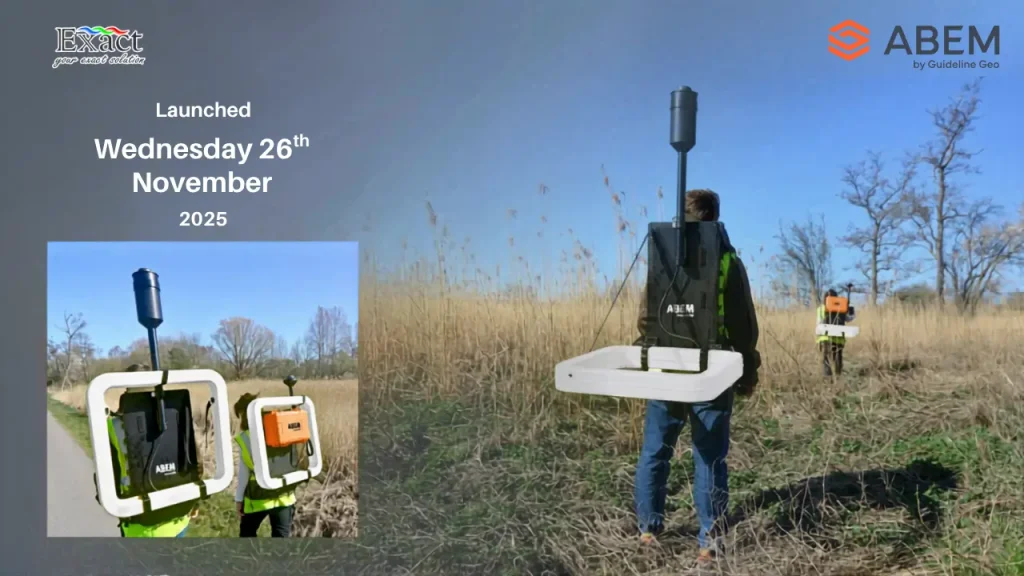
The ABEM GroundTEM Trek is a revolutionary “Walking TEM” solution designed to help mining companies in Indonesia meet the urgent RKAB 2026 deadlines and strict MinerbaOne reporting requirements. By replacing slow, traditional cable-based methods with a lightweight, backpack-mounted system, this technology enables 10x faster mapping of the subsurface in real time.Key highlights of the system include:Superior Portability: The system is entirely cable-free and worn on the backs of two operators, with the receiver backpack weighing 10 kg and the transmitter backpack weighing 15 kg.Optimized for Nickel Laterite: It accurately maps the complex electrical contrasts between resistive caprock and conductive limonite and saprolite zones at depths of 50 to 100 meters.Real-Time Visualization: Using an Android mobile app, operators can view live pseudo-2D color sections and 1D inversions directly in the field, allowing for immediate geological insights.Rugged Design: Built for extreme Indonesian terrain, the hardware is IP67-rated, making it completely resistant to dust and heavy tropical rain.Operational Precision: A built-in “Coil Distance Regulator” ensures data quality by monitoring the 15-meter operator spacing in real time via visual and audible alerts.Continuous Mapping: The system’s dual-moment transmitter and high-density logging allow crews to map hectares of land daily, eliminating zero-value setup time.This advanced geophysical tool, distributed by PT. Exact Global Teknologi, is the ultimate strategy for accelerating exploration and securing mining permits in Indonesia’s demanding environments
The Walking TEM Revolution in Indonesia: How ABEM GroundTEM Trek Accelerates Subsurface Mapping by 10x
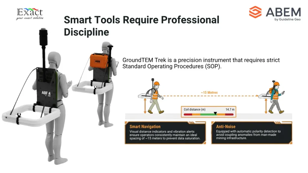
The ABEM GroundTEM Trek, represented by PT. Exact Global Teknologi, introduces the “Walking TEM” era, enabling subsurface mapping that is 10 times faster by eliminating the need to lay traditional cable loops. This portable dual-backpack system features a 15 kg Transmitter and a 10 kg Receiver, specifically designed to overcome the logistical challenges of extreme terrains like dense jungles and swamps. With high-precision capabilities, the instrument reaches accurate target depths of 50 to 100 meters, making it highly effective for Nickel Laterite exploration, groundwater detection, and geotechnics. The system utilizes a dual-moment transmitter (1A and 10A) with a 4 MHz sample rate for superior soil conductivity recording and is ruggedized with an IP67 rating for dust and rain resistance. By offering automatic 1D inversion and real-time subsurface profiling via an Android application, this technology accelerates projects and removes zero-value setup time by allowing for continuous mapping while walking
Official Distributor of ABEM GroundTEM i-Series Indonesia: Fastest Groundwater & Mineral Survey Tool — Finishes 5 Points/Day!
Official Distributor of ABEM GroundTEM i-Series Indonesia: Fastest Groundwater & Mineral Survey Tool
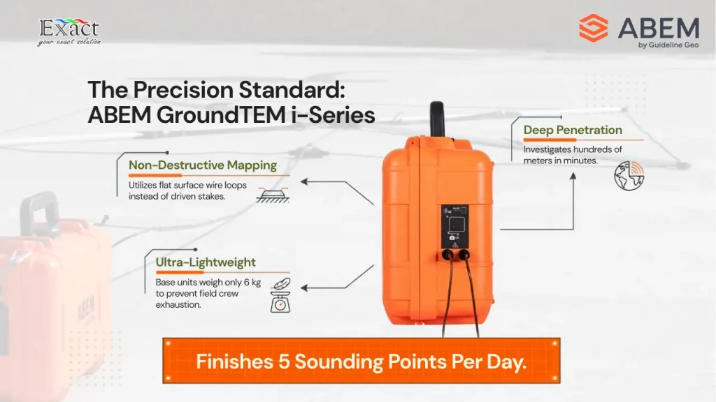
As we prepare for Mineral Deposit Exploration 2026, field efficiency and data precision have become the top priorities for geophysicists across the archipelago. The ABEM GroundTEM i-Series stands out as Indonesia’s fastest survey tool, enabling field teams to complete up to five sounding points per day by eliminating the need for invasive electrodes and heavy cabling.
By utilizing the Transient Electromagnetic (TEM) method, this system captures high-resolution subsurface data through magnetic induction, reaching depths of hundreds of meters in just minutes. Featuring advanced dual-moment technology, the i-Series provides simultaneous precision for both shallow and deep geological structures.Designed for the rugged Indonesian terrain with an IP65 rating and wireless Android app control, it offers a “Real-time inversion” feature for immediate on-site decision-making. Partner with PT. Exact Global Teknologi, the official distributor, to revolutionize your exploration workflows with the most portable and powerful TEM solution on the market.
Optimizing Deep Aquifer Exploration in Indonesia: Accuracy Analysis of Transient Electromagnetic Method (TEM) vs Resistivity
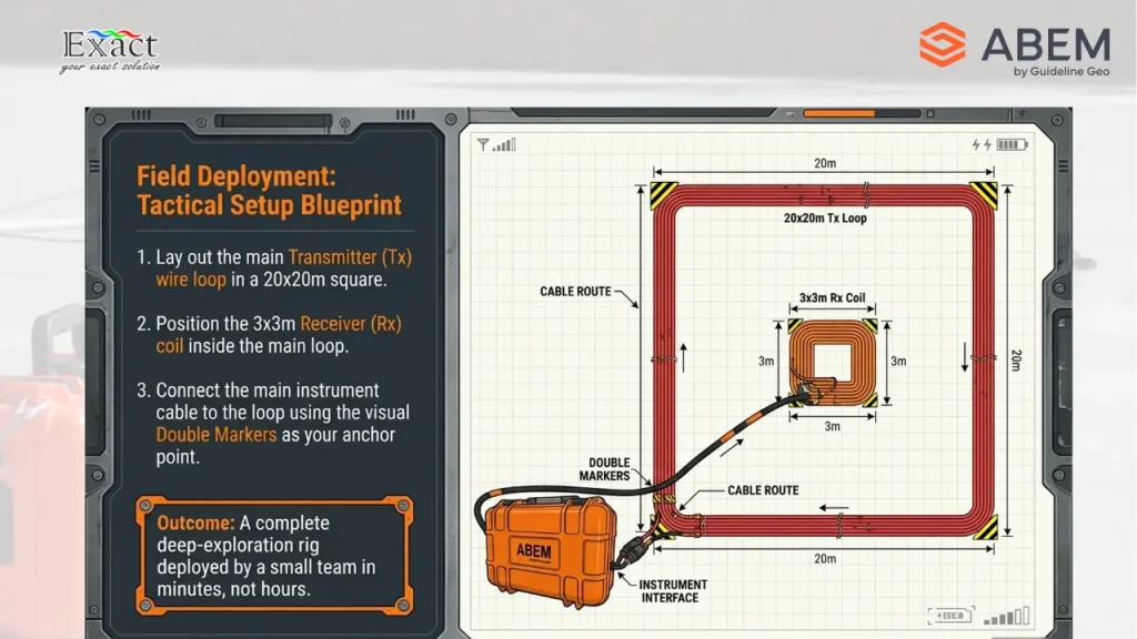
As Indonesia’s infrastructure grows, the transient electromagnetic method in indonesia has become the gold standard for subsurface mapping. Traditional resistivity often struggles with the archipelago’s dense forests and deep targets, but our analysis shows that TEM offers superior speed and depth penetration.
In this guide, we compare TEM vs. Resistivity accuracy for deep targets. Discover why the ABEM GroundTEM i-Series is the premier deep groundwater detection tool >200 meters, offering unmatched portability, IP65 durability, and real-time inversion for Indonesia’s toughest terrains.
Whether you are mapping saline intrusion or searching for mineral deposits, learn how to optimize your exploration workflow with a trusted Distributor ABEM GroundTEM. Reach your project goals with data-driven precision and professional-grade geophysical results.
Optimizing Utility Mapping: Combining GPR & RD8200 for Accurate Detection (Available in Indonesia)
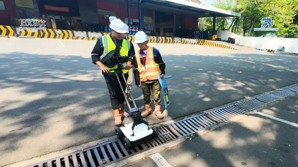
Underground infrastructure in major Indonesian hubs like Jakarta and Surabaya is becoming more congested every day, leading to a recurring risk of buried utility strikes. As geophysics professionals, we can no longer rely on a single technology; using only one means working “half-blind”. Learn how the strategic combination of Ground Penetrating Radar (GPR) and the Radiodetection RD8200 series creates a complete subsurface picture—ranging from conductive metal pipes and power cables to non-conductive PVC water pipes and fiber optic lines . With advanced features such as the Swing Warning System and Dynamic Overload Protection, data accuracy is maintained even in noisy, complex urban environments. Discover our recommended 3-phase workflow for precision results with PT. Exact Global Teknologi, the authorized Radiodetection agent in Indonesia.
RD8200 vs. RD8200G: Technical Specification Comparison – Which Utility Locator is the Smarter Investment?
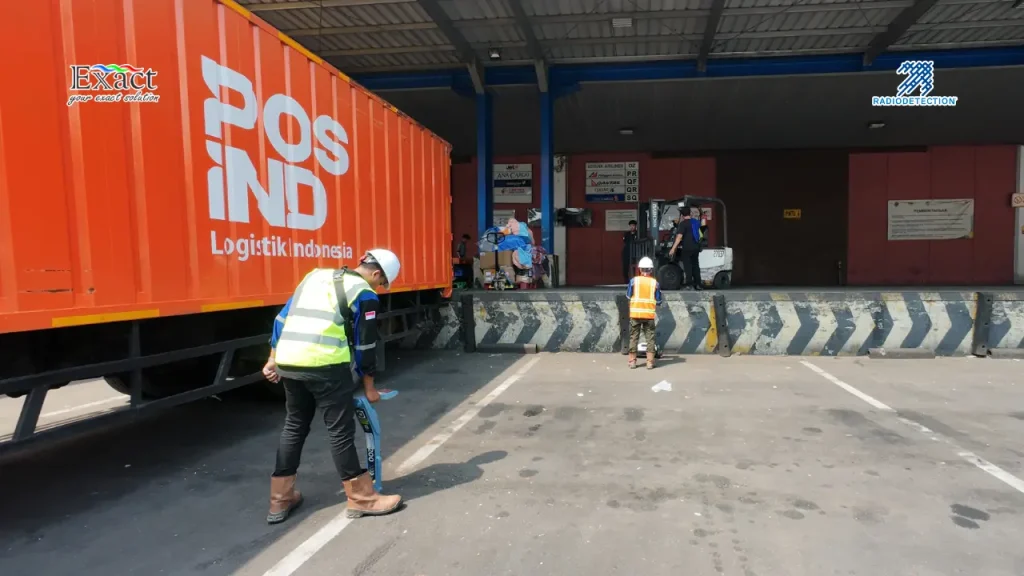
Eliminate blind spots in subsurface utility mapping with the synergy of GPR and the RD8200 series. Learn our proven 3-phase methodology to accurately locate PVC and metallic pipes across Indonesia with PT. Exact Global Teknologi . Click for the full technical guide and equipment solutions backed by an industry-leading 3-year warranty.
Jakarta’s Sidewalk Utility Mapping Solution with a Compact 3D GPR ArrayJakarta’s Sidewalk Utility Mapping Solution with a Compact 3D GPR Array
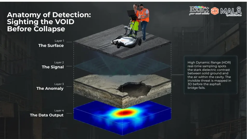
Traditional single-line GPR methodologies rely on a back-and-forth grid pattern, which inherently creates “blind spots” in the blank spaces between survey lines. The MIRA Compact utilizes a multichannel 3D GPR array to capture a continuous, dense 3D volume in a single pass. This eliminates the need for speculative interpolation, revealing the exact layout, depth ($Z$-axis), and orientation of buried assets with absolute confidence.
Stop Guessing Where the Pipes Are: Why Jakarta’s Sidewalk Projects Must Adopt 3D GPR in Indonesia
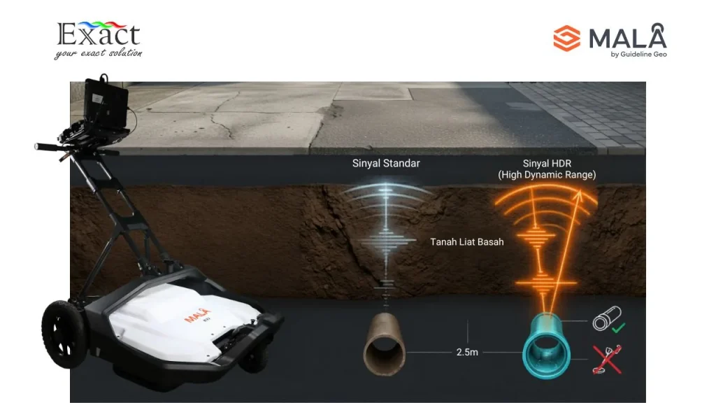
The Challenge: Jakarta’s Narrow Paths and “Blind” Maps
Mapping underground infrastructure in dense urban environments like Jakarta is a high-stakes challenge. Existing utility maps are often outdated or inaccurate, and the physical constraints of narrow 1.5-meter sidewalks make traditional mapping methods nearly impossible to execute. In these restricted spaces, construction teams often resort to “blind trenching,” which leads to dangerous utility strikes, massive water leaks, and billions of Rupiah in fines.
Stop Buying Fragile Scanners: Why XenoTrack is the Best Investment for a Mobile Mapping System product in Indonesia?
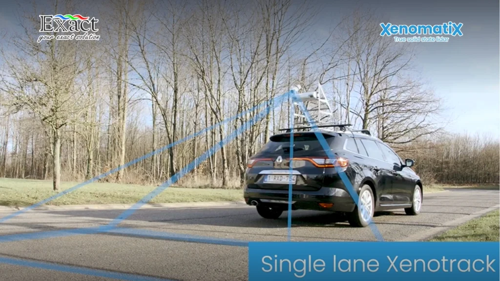
We must stop buying fragile scanners that cannot handle real-world conditions. Discover why the true solid-state XenoTrack is the most logical investment for a Mobile mapping system product di Indonesia , delivering 6D road scanning and automated AI defect detection without closing active traffic.
Preventing Fatal Losses: Millimeter-Level Accuracy of Mobile Mapping Systems for Road and Runway Inspection in Indonesia
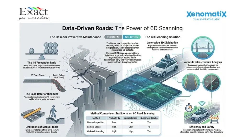
Relying on fragile, outdated scanners for infrastructure inspection puts your project budgets and public safety at immense risk. Discover how upgrading to a true solid-state Mobile Mapping System delivers millimeter-accurate 6D digital twins—allowing you to detect hidden defects, automate IRI calculations, and prevent fatal losses without ever disrupting traffic.

