Finding what lies beneath the ground is no longer a matter of guesswork. For years, engineers and surveyors in Indonesia have faced a recurring nightmare: striking a buried fiber optic cable or a high-pressure water pipe because maps were outdated or inaccurate. When we look at the biggest challenges facing our customers today, strike reduction and operational efficiency are always at the top of the list.
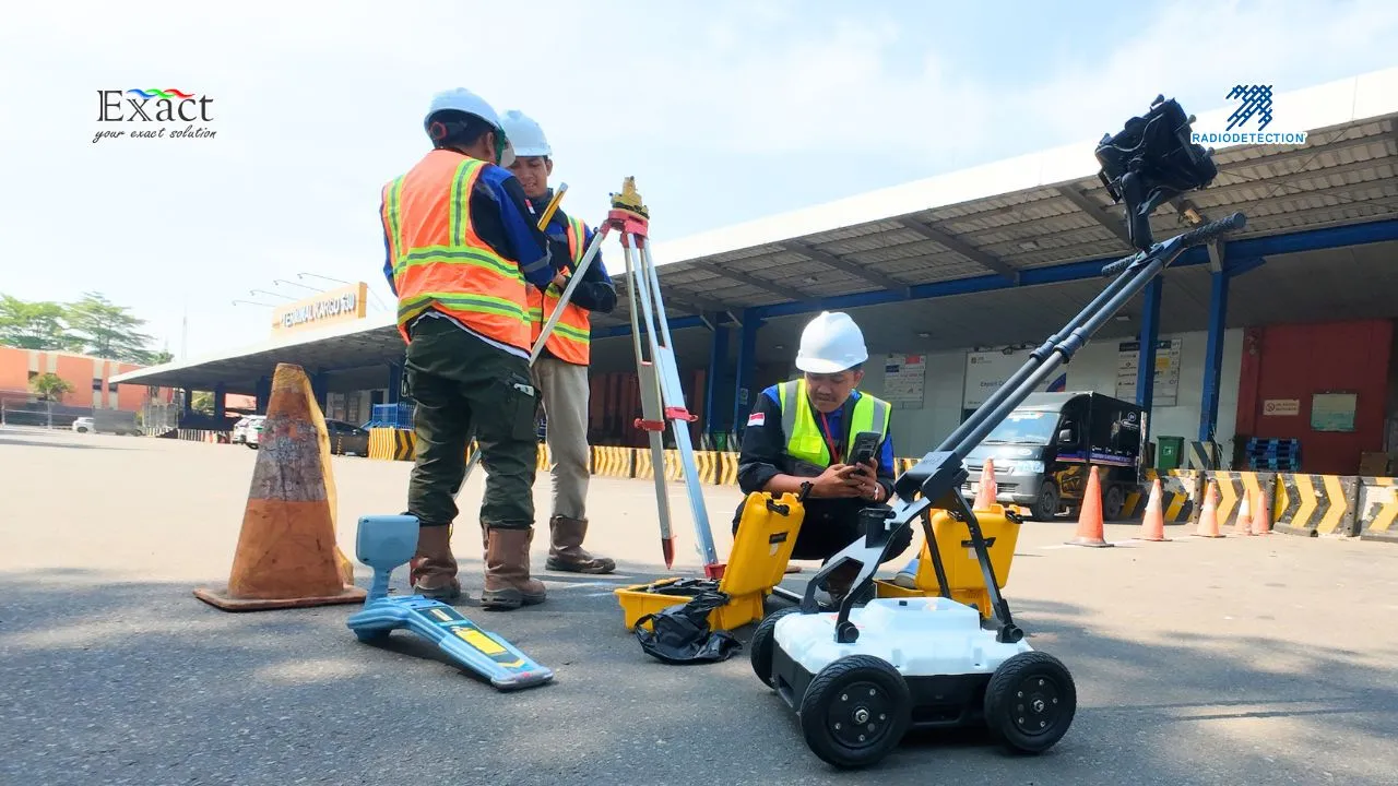
The underground infrastructure in our cities is becoming more congested every day. In major hubs like Jakarta, Surabaya, or Medan, the underground environment is a complex mix of legacy metal pipes, modern PVC conduits, and high-voltage power lines all competing for space. To navigate these networks safely and accurately, we need the best tools available. This brings us to a powerful strategy: combining Ground Penetrating Radar (GPR) and the Radiodetection RD8200 series to create a complete picture of what lies beneath our feet.
The Strategy: Why Combining GPR and RD8200 is Essential
When we map underground utilities, we cannot rely on a single technology to find every type of pipe and cable. If we use only one type of technology, we are essentially working half-blind. This is where combining GPR and RD8200 becomes our most effective approach.
- The RD8200 Advantage: This range is our most advanced set of precision cable and pipe locators. It excels at detecting electromagnetic signals. We use it to trace conductive utilities like metal pipes, power cables, and telecom lines by picking up active signals from a transmitter or passive signals radiating from the lines.
- The GPR Advantage: Many modern networks use non-conductive materials like PVC water pipes or fiber optic cables without tracer wires. GPR sends radar pulses into the ground and reads the echoes that bounce back off buried objects, regardless of their material.
- The Synergy: While an electromagnetic locator is excellent for tracing metal pipes, it cannot “see” a plastic water pipe. Conversely, GPR can detect non-metal objects but may struggle in highly conductive clay soils common in parts of Indonesia. By combining them, we eliminate these blind spots.
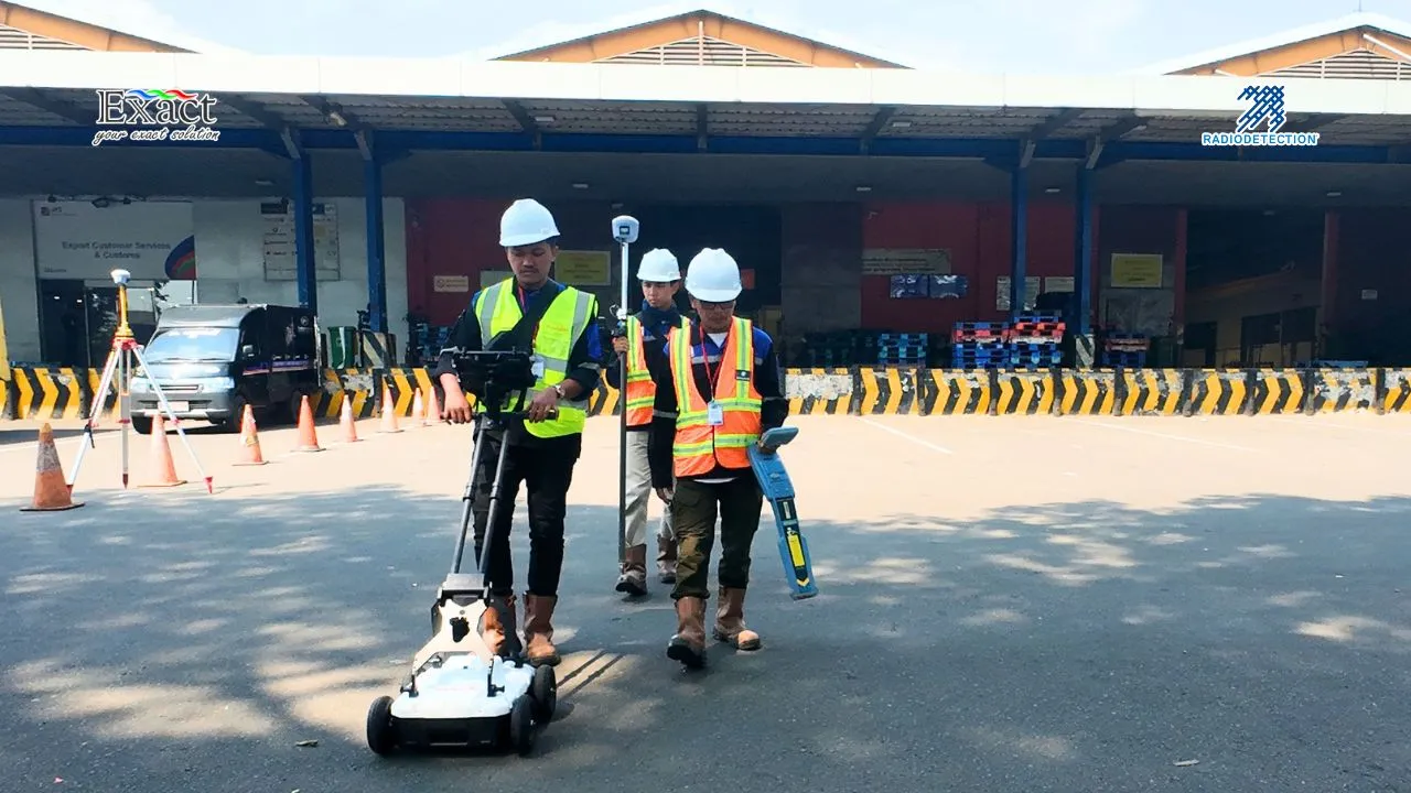
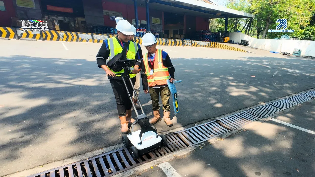
Our Recommended 3-Phase Workflow
- Phase 1 (EM Tracking): We use the RD8200 to quickly and accurately trace the exact path and depth of all conductive lines, creating the “backbone” of the underground network.
- Phase 2 (GPR Scanning): We sweep the area with GPR to look for anomalies the RD8200 cannot see, such as plastic gas pipes or concrete structures.
- Phase 3 (Data Integration): We combine these data sets to ensure we do not miss anything, drastically minimizing the risk of accidents.
Features of the RD8200 Series That Drive Accuracy
The RD8200 range, designed and built in Great Britain, is built around the operator’s needs. These tools are ergonomic, lightweight, and perfectly balanced for comfortable use during long shifts.
- Sunlight-Readable Display: Both models use transflective LCD technology that relies on ambient light, meaning the screen actually becomes clearer and easier to read in direct, bright sunlight.
- Built for Harsh Conditions: The shock-resistant casing boasts an IP65 rating, protecting against knocks, drops, water jets, and dust. They operate perfectly in temperatures ranging from -4°F to 122°F (-20°C to 50°C).
- Swing Warning System: To get accurate depth readings, the locator must be kept perpendicular to the ground. If we swing the device excessively, a built-in gyroscopic system triggers audio and vibration alerts to correct our posture.
- StrikeAlert and Vibration Feedback: These locators provide visual, audio, and vibration warnings when they detect a shallow utility line less than 30cm deep. The handle vibrates so we do not miss warnings in noisy environments.
- Dynamic Overload Protection: This automatically filters out unwanted electrical interference from substations or overhead power lines, allowing us to work accurately in electrically noisy environments.
Technical Specifications & Capabilities
The RD8200 gives us incredible flexibility with five active locate modes, including Peak+ which adds the benefits of Guidance or Null arrows to the high accuracy of Peak mode.
- Frequency Range: The locator supports 21 active frequencies from 98Hz up to 200kHz. It also features 4 sonde frequencies for tracing non-conductive pipes using a pushed sonde.
- Fault Find Mode: By combining the unit with a transmitter and an accessory A-frame, we can identify and pinpoint cable sheath damage to within 4 inches (10cm).
- iLOC Remote Control: A long-range wireless link allows us to control the transmitter’s power, frequency, and SideStep functions from up to 1,400 feet (450 meters) away.
- Longer Run-Time: While standard D-Cell batteries provide 13 hours of use, we highly recommend the Lithium-Ion rechargeable battery pack, which provides 35 hours of continuous run-time.
Why Trust PT. Exact Global Teknologi?
In Indonesia, high-tech equipment is only as good as the support behind it. As the authorized agent for Radiodetection, PT. Exact Global Teknologi ensures we get genuine British-made equipment.
When you partner with them, you get an industry-leading 3-year warranty upon registration and comprehensive localized technical support. They provide hands-on training tailored to our specific needs and Indonesian soil conditions. Whether you are conducting a small repair or a massive 20km pipeline survey across West Java, they maintain ready stock to ensure you get your equipment when you need it.
Contact PT. Exact Global Teknologi Today:
- Website: www.exactglobal.co.id
- Email Marketing: marketing@exactglobal.co.id
- WhatsApp: +62 812-9252-3900
Frequently Asked Questions (FAQ)
-
Why is combining GPR and RD8200 considered the best practice?
The RD8200 is designed to trace electromagnetic signals from conductive materials like metal pipes and live power cables. GPR uses radar to find non-conductive materials like plastic pipes or concrete. By using both tools, we ensure that every single utility is mapped, leaving zero blind spots on our work sites.
-
Can the RD8200 detect plastic pipes?
Directly, no. The RD8200 detects signals on conductive materials. To find plastic pipes, we recommend using GPR or inserting a traceable “sonde” or “rodder” into the pipe so the RD8200 can track it.
-
Does GPR work well in all Indonesian soils?
GPR performance depends on soil conductivity. In dry, sandy soil, it penetrates very deep. In wet, heavy clay common in parts of Indonesia, the depth might be limited. This is exactly why the combination with an RD8200 is so important—it ensures you have a backup method when soil conditions are tough.
-
How does the Swing Warning system protect the accuracy of our data?
For the TruDepth feature to give accurate readings, the locator must be held straight up and down. The RD8200 has an internal gyroscopic sensor that triggers haptic vibrations and audio/visual alerts if you swing the device excessively, forcing you to correct your posture.
-
How long does the battery last on the RD8200?
The standard setup with two D-Cell alkaline batteries lasts about 13 hours. Upgrading to the custom Lithium-Ion rechargeable pack provides up to 35 hours of continuous run-time, significantly reducing operating costs.
-
Where can I buy or get a demo of these tools in Indonesia?
You can purchase the RD8200 series and all accessories through PT. Exact Global Teknologi. They are the authorized agent in Indonesia, providing sales, technical support, and demonstrations on your actual job site.


