The need for data efficiency and accuracy in Indonesia’s construction and mining industries continues to rise sharply. We notice that many companies still face major challenges when managing material inventory or daily logistics operations. To answer these challenges, we present the latest innovation in survey SLAM LiDAR stockpile services in Indonesia. Through cutting-edge technology, stockpile mapping work that previously took days can now be completed in just minutes.
Here are four facts and steps on how we bring major changes to stockpile mapping in the field.
Leaving Behind the Conventional Method of Raw Material Volume Survey
For years, many factories and mining areas have relied heavily on old ways. We observe that the conventional method of raw material volume survey often takes a very long time and can disrupt the operations of heavy equipment working in the field.
The recording system in this old method is also often not well integrated digitally. As a result, this method is very prone to inventory calculation discrepancies. If this difference continues, the company will experience significant material losses in the long run. Therefore, we realize the need to transition to a three-dimensional scanning system that is much faster, safer, and completely contactless.
All-In-One Handheld 3D Laser Scanner Solution
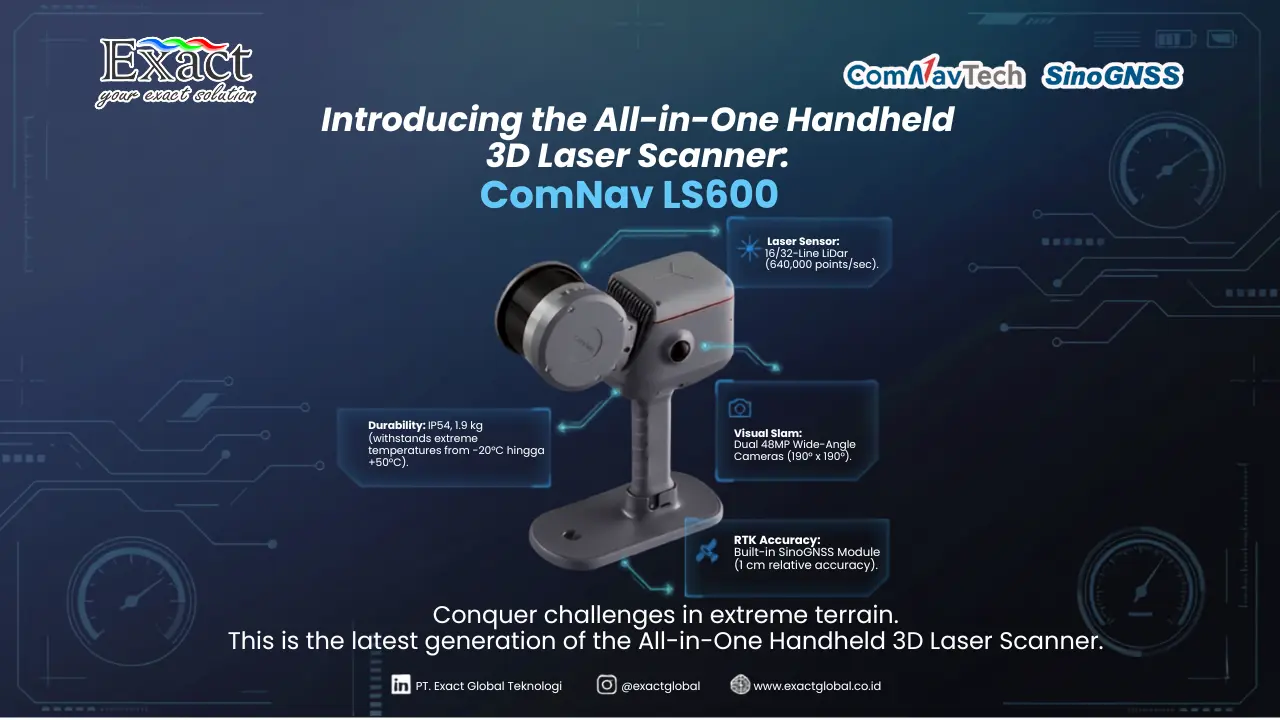
As a solution to the slow old methods, we present an advanced scanning device. This device is an all-in-one handheld 3D laser scanner, a new generation of handheld 3D scanners designed to overcome various obstacles in difficult terrains. One of the best technologies we rely on is the SinoGNSS LS600.
The design of this handheld scanner is very light, weighing only 1.9 kilograms, which already includes the battery and Ground Control Point collection plate. Its body uses impact-resistant aluminum with IP54 certification, making it highly resistant to dust and water splashes in mining sites and construction areas. We can operate it in extreme temperature ranges, starting from -20°C up to +50°C. This portable scanner provides us with high flexibility when mapping large and irregular stockpile areas.
The Advantages of an Integrated Device GNSS SLAM IMU
The secret behind our speed and high precision lies in multi-sensor fusion technology. The device we use is an integrated device GNSS SLAM IMU. This means the LiDAR system, Inertial Measurement Unit (IMU), Camera, and Global Navigation Satellite System (GNSS) receiver antenna module are embedded into a single hardware unit.
Unlike scanner products from other brands that require an external GNSS module (split type), the full integration in our device provides many benefits:
- High Accuracy: Thanks to the built-in RTK (Real-Time Kinematic) module that tracks various satellite constellations (GPS, BDS, GLONASS, Galileo), we can achieve a relative processing accuracy of up to 1 centimeter.
- Realistic Visuals: Two 48-Megapixel wide-angle cameras capture colors with a 190° x 190° field of view. This feature is combined with Visual-SLAM (V-SLAM) to produce highly detailed colored three-dimensional point clouds.
- High-Speed Scanning: We have 16-line or 32-line laser configuration options with a range of up to 120 meters or 300 meters. In just one second, the sensor can emit and capture up to 640,000 points.
Case Study: Fast 198-Meter Stockpile Mapping
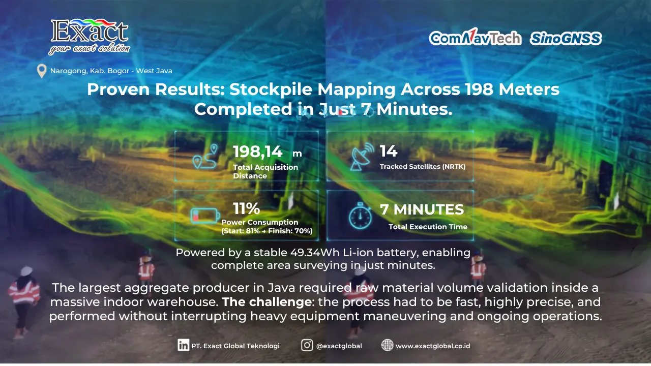
To provide a clear picture of this tool’s capabilities in the real world, we conducted a direct survey at one of our major clients’ facilities, PT. Solusi Bangun Indonesia Tbk (SBI) in Narogong, West Java. PT. SBI is the largest aggregate material provider in Java, supplying crushed stone and concrete needs for crucial infrastructure projects.
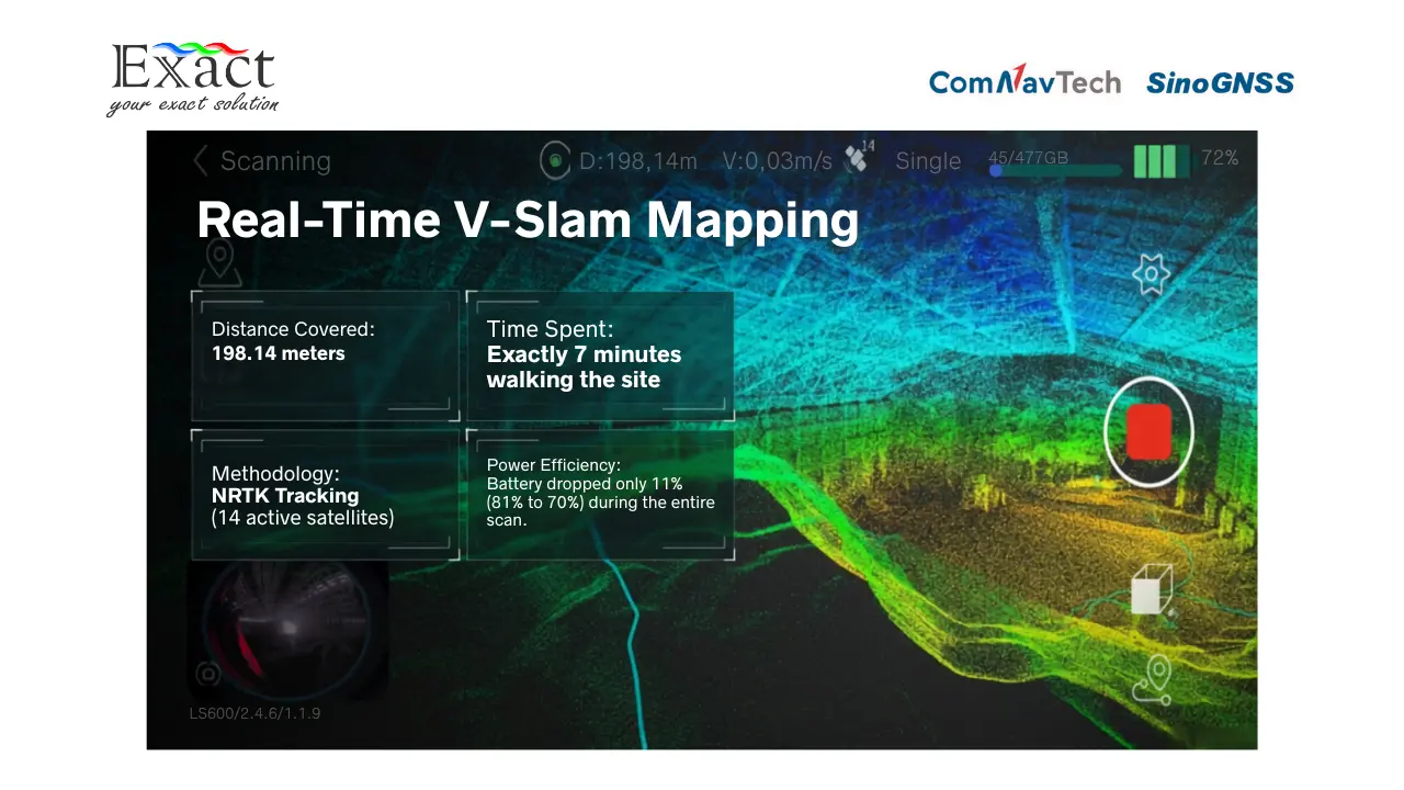
Our team conducted data collection mapping the raw material stockpile inside a closed warehouse building (indoor) using the SLAM LS600 device. Previously, similar activities would take a very long time and heavily disrupt heavy equipment operations. However, we successfully completed the survey with the following parameters:
- Instrument used: SinoGNSS LS600.
- Survey method: NRTK tracking 14 satellites.
- Battery Condition: The built-in battery can last up to 1.5 hours of operation. We started the mapping with an 81% battery capacity and finished at 70%.
- Distance Covered: The total area we had to scan reached a length of 198.14 meters.
- Total Time: We walked to comprehensively scan the entire stockpile area in just 7 minutes.
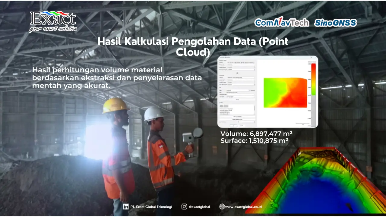
After the field data acquisition phase was complete, we transferred the raw data files via USB connection (U-Disk Mode) into a computer. We then processed the point cloud using advanced software like ScanMaster and RealEditor (LiDAR360 MLS) for sensor alignment, moving object filtering, and 3D model creation.
The final calculation results showed that the total material volume inside the PT. SBI warehouse was 6,897.477 cubic meters with a surface area reaching 1,510.875 square meters. The entire process from start to finish was much faster compared to any method the company had ever used before.
Frequently Asked Questions (FAQ)
-
How long does the battery of this handheld scanner last in the field?
The handheld 3D scanner we provide has a 49.34Wh Li-ion battery capacity that operates stably for up to 1.5 hours in continuous use. Our survey process is usually very fast (less than 10 minutes for large areas), so one battery is more than enough for most jobs.
-
Can this scanner be used in bad weather conditions or dusty environments?
Yes, this device is coated with industrial-grade aluminum with an IP54 resistance rating. This means our tool is resistant to thick dust in mining areas as well as rainwater splashes, and it operates normally in extreme temperatures from -20°C to +50°C.
-
What data formats are supported by this point cloud processing system?
Our point cloud data output directly produces the actual .las format. Inside the processing software (RealEditor), we can export or read various industry-standard formats such as LAS, LAZ, PLY, E57, and DXF for direct use in GIS and CAD software.
-
Why is integrated technology (Integrated Device) better than separate devices (Split Type)?
The integrated design (GNSS, SLAM, IMU, Battery) in one body makes it very compact, does not require many troublesome cables when carried around, and minimizes the risk of synchronization interference between sensors when moving in open fields or narrow areas.
About Us We are a provider of cutting-edge solutions in geospatial technology and mapping instrumentation in Indonesia. For more information on procuring 3D Lidar technology services or products, please contact us:
Exact Global Teknologi
Website : www.exactglobal.co.id
Email : marketing@exactglobal.co.id
WhatsApp : +62 812-9252-3900