Fast 198-Meter Stockpile Mapping in Just 7 Minutes
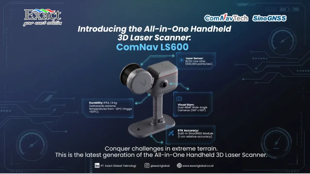
Managing material inventory effectively requires high data accuracy and operational efficiency. Transitioning from slow, conventional contact methods, our latest stockpile mapping service utilizes the integrated GNSS SLAM IMU technology of the SinoGNSS LS600 handheld scanner. Weighing only 1.9 kg with an IP54 industrial rating, this rugged device captures up to 640,000 points per second and utilizes dual 48-Megapixel cameras to generate realistic, colored 3D point clouds. Our successful case study at the PT. SBI warehouse proved its real-world capability, where a 198.14-meter long stockpile was comprehensively scanned in a mere 7 minutes and seamlessly processed into industry-standard CAD/GIS formats using ScanMaster and RealEditor software.
For a detailed technical breakdown and guidelines, you can review the official SLAM LS600 or contact our engineering team directly.