Geophysical Equipment Rental: 6 Essential Subsurface Instrument Solutions for Indonesia Projects
Unexpected subsurface conditions can halt your project and inflate costs. Learn how renting field-ready geophysical instruments—from 3D GPR to microseismic sensors—can secure your data, meet strict deadlines, and convert heavy capital expenditure (CAPEX) into manageable OPEX.
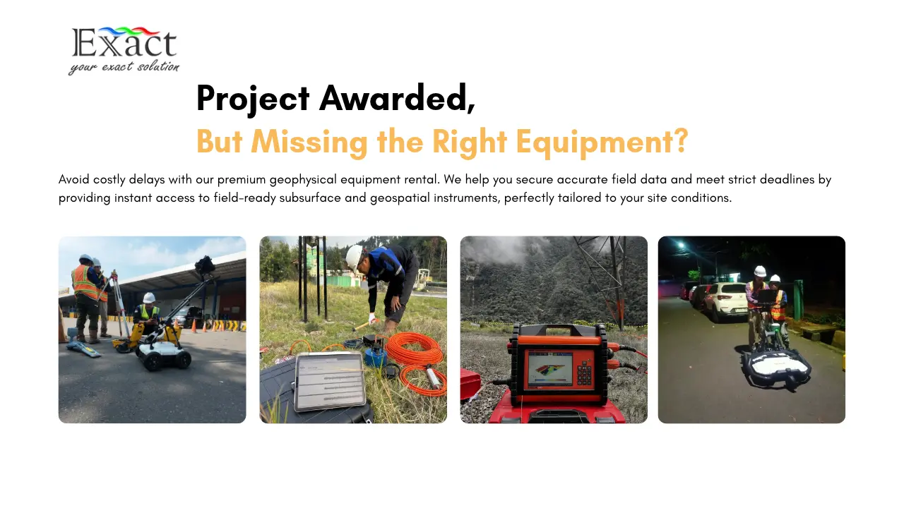
Did you know that unexpected subsurface conditions and utility strikes cause up to 50% of civil engineering project delays and cost the global infrastructure sector more than $30 billion every single year?
In Indonesia, where massive infrastructure and resource corridors cut across complex volcanic geology, thick peat soils, and unmapped urban utility webs, subsurface uncertainty is the single greatest hazard to your project schedule and bottom line.
Every project comes with its own unique specifications and requirements. Forcing whatever equipment happens to be on hand often leads to questionable, inconclusive field data. Yet, when project deadlines are pressing and purchasing brand-new imported equipment is not a viable option, renting is your most tactical step forward.
That is why engineering teams, mining operators, and exploration consultants rely on geophysical equipment rental. Rather than locking up significant capital expenditure (CapEx), renting turns equipment into flexible operating expenses (OpEx) while giving you instant access to certified, field-ready instruments.
At PT Exact Global Teknologi, we help you map out your project from day one. In this comprehensive guide, we walk you through our 6 core geophysical rental instrument solutions designed to help you tackle demanding ground challenges across Indonesia.
Summary: Why Rent Subsurface Equipment from Us?
- Zero Capital Overhead: Avoid massive upfront capital commitments, customs clearance delays, and asset depreciation.
- No Maintenance or Recalibration Burden: Every instrument leaves our certified workshop fully calibrated, updated, and ready for immediate deployment.
- Targeted Geological Solutions: Select the exact frequency, receiver channels, and antenna depth configuration required for your specific survey environment.
- Distributor-Backed Field Reliability: Deploy genuine equipment from world-leading manufacturers backed by certified ISO 9001:2015 and ISO 45001:2018 operational standards.
6 CORE GEOPHYSICAL RENTAL SOLUTIONS
- Underground Utilities: Radiodetection RD8200, MALÅ MIRA 3D Compact, MALÅ GroundExplorer, & MALÅ Easy Locator Core.
- Groundwater Exploration: ABEM Terrameter LS 2 & ABEM GroundTEM i10.
- Microseismic Monitoring: GEObit C100, S100, GEOTINY, GEOTHREE, & GEOSIX.
- Structural Health Monitoring: GEObit GEOwarning, GEO A200, & GEOTINY 10.
- Mineral Exploration: MALÅ ProEx, MALÅ GroundExplorer (GX), & ABEM Terrameter LS 2.
- Geotechnical Investigation: MALÅ ProEx & ABEM Terrameter LS 2.
1. Underground Utilities
- Application Focus: Subsurface utility engineering (SUE) & damage prevention.
- Rented Instruments: Radiodetection RD8200, MALÅ MIRA 3D Compact, MALÅ GroundExplorer, & MALÅ Easy Locator Core.
- Critical Benefit: Prevents costly, life-threatening utility strikes.
- Primary Industries: Urban construction, road widening, pipeline expansion.
Digging without a utility map is the equivalent of gambling with the risk of utility strikes. Accidental utility hits-whether puncturing a high-pressure gas main, severing a high-voltage transmission cable, or breaking a municipal water line-can result in severe project disruptions, expensive liabilities, and fatal accidents.
Our underground utility rental package pairs precision electromagnetic locators with plug-and-play Ground Penetrating Radar (GPR) systems so you can ensure your excavation path is completely safe before heavy machinery starts digging.
Available Rental Instruments:
- Radiodetection RD8200: The industry standard for precision damage prevention across congested underground networks. Featuring patented TruDepth™ technology and Dynamic Overload Protection, it filters out severe electrical noise from nearby substations and overhead high-voltage lines, verifying precise depth readings only when the locator is correctly oriented.
- MALÅ MIRA 3D Compact: A multi-channel 3D GPR antenna array operating at 500 MHz. It captures high-density volumetric 3D subsurface data in a single drive, mapping complex underground infrastructure across roadways, industrial sites, and airport taxiways.
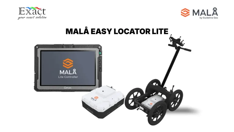
- MALÅ Easy Locator Core: An ultra-lightweight, folding HDR GPR cart equipped with AI-assisted software interpretation. It is purpose-built for fast urban trench clearance and accurately detects both metallic and non-metallic utilities (PVC, HDPE, clay, and fiber-optic conduits).
- MALÅ GroundExplorer (GX): High Dynamic Range (HDR) GPR available with 450 MHz and deep-penetrating 160 MHz antennas. Featuring integrated DGPS for positioning, it provides superior signal-to-noise performance and deeper penetration when tracing deep drainage culverts and buried pipes.
Where We Deploy This:
- Pre-excavation clearance for urban mass transit and road expansions in congested metro areas like Jakarta, Surabaya, and Medan.
- Verifying as-built utility documentation for industrial plants and refinery complexes.
2. Groundwater Exploration
- Application Focus: Aquifer delineation, depth modeling, & water management.
- Rented Instruments: ABEM Terrameter LS 2 & ABEM GroundTEM i10.
- Critical Benefit: Sharp vertical aquifer resolution with lightweight setups.
- Primary Industries: Agriculture, industrial drilling, community clean water.
Conducting resistivity and transient electromagnetic surveys does not need to be an exhausting physical ordeal for your field crew in challenging tropical conditions. In the past, deep groundwater soundings required heavy motor generators, bulky standalone transmitters, separate receiver units, and kilometers of unwieldy cables.
We provide modern, compact systems with streamlined, efficient cable layouts that maximize field productivity while delivering sharp aquifer depth resolution with far less physical strain.
Available Rental Instruments:
- ABEM Terrameter LS 2 (12-Channel / 81-Electrode Configuration): A world-leading data acquisition system for 2D and 3D Electrical Resistivity Tomography (ERT) and Induced Polarization (IP) surveys. Its 12 measurement channels collect data significantly faster than standard single-channel units, handling complex field setups with up to 81 active electrodes to map groundwater tables, gravel aquifers, and confining clay layers down to 200+ meters.
- ABEM GroundTEM i10: A compact, fast-deployment Transient Electromagnetic (TEM) system designed to explore deep conductive stratigraphy. Driven by an integrated 10A Dual-Moment transmitter and controlled wirelessly via an intuitive Android application, it resolves both shallow layers and deep aquifers down to 300 meters without requiring heavy field gear.
Where We Deploy This:
- Deep production well siting for manufacturing plants, agricultural estates, and remote mining camps across Sumatra, Kalimantan, and East Indonesia.
- Mapping freshwater-saltwater interfaces to prevent coastal aquifer salinization.
3. Microseismic Monitoring
- Application Focus: Seismic network arrays, passive listening, & hazard QA.
- Rented Instruments: GEObit C100, S100, GEOTINY, GEOTHREE, & GEOSIX.
- Critical Benefit: Ultra-low noise recording of subtle ground vibrations.
- Primary Industries: Geothermal energy, mining, seismology, volcanology.
When designing and deploying a reliable seismological observation network, instrument sensitivity is everything. High ambient electrical and thermal noise can easily drown out weak microseismic events caused by hydraulic fracturing, deep fluid migration, or early volcanic movement.
Our GEObit rental instruments feature ultra-low-noise sensors and high-resolution digitizers that ensure even the subtlest vibrations from local tectonic tremors to volcanic micro-earthquakes are recorded with pristine signal clarity.
Available Rental Instruments:
- GEObit C100 & S100 Sensors: High-fidelity short-period and broadband seismometers engineered for surface, vault, and borehole installations.
- GEObit GEOTINY & GEOTINY AC10: Ultra-compact digital seismographs and accelerographs combining sensor and digitizer in a single rugged enclosure.
- GEObit GEOTHREE & GEOSIX Recorders: Multi-channel seismic acquisition consoles offering high dynamic range, built-in GPS timing synchronization, low power consumption, and real-time network streaming over wireless links.
Where We Deploy This:
- Induced seismicity tracking around geothermal injection wells and oil & gas reservoirs.
- Passive seismic investigations, including Horizontal-to-Vertical Spectral Ratio (HVSR) site resonance testing and MASW geotechnical site classification.
- Slope vibration and seismicity monitoring across active open-pit mines and volcanic regions.
4. Mineral Exploration
- Application Focus: Deep structural mapping, vein tracing, & target ranking.
- Rented Instruments: MALÅ ProEx, MALÅ GroundExplorer (GX), & ABEM Terrameter LS 2.
- Critical Benefit: Deep penetration and multi-channel structural modeling.
- Primary Industries: Base & precious metal mining, industrial quarries.
Hunting for mineralized zones in remote greenfield and brownfield environments requires true field “workhorses”. Drilling exploration boreholes without surface geophysical constraints is financially risky and inefficient. You need dependable geophysical tools to map subsurface contacts, fault systems, and chargeability anomalies before committing to costly drilling programs.
By pairing the high penetration depth of specialized GPR with multi-channel resistivity systems, our rental packages reveal complex geological structures and delineate high-potential targets with confidence.
Available Rental Instruments:
- MALÅ ProEx & MALÅ GX: Modular GPR systems capable of driving low-frequency rough-terrain antennas and 160 MHz HDR units to profile weathered overburden, delineate shallow placer deposits, and map fracture networks in bedrock.
- ABEM Terrameter LS 2: Multi-channel resistivity and time-domain IP acquisition system.[cite: 4] In mineral surveys, its IP measurement mode detects disseminated metallic sulfides and quartz veins that do not exhibit strong resistivity contrasts alone.
Where We Deploy This:
- Delineating silica veins, gold-bearing sulfide zones, and lateral laterite nickel profiles in Sulawesi, Halmahera, and Kalimantan.
- Mapping structural fault lines, shear zones, and lithological contacts prior to deep exploration drilling campaigns.
5. Structural Health Monitoring (SHM)
- Application Focus: 24/7 continuous dynamic vibration & structural integrity.
- Rented Instruments: GEObit GEOwarning, GEO A200, & GEOTINY10.
- Critical Benefit: Real-time autonomous threshold alerting via telemetry.
- Primary Industries: Large dams, suspension bridges, high-rises, tunnels.
The safety and stability of hydroelectric dams, major bridges, and high-rise buildings leave zero room for compromise. Civil infrastructure experiences continuous dynamic stresses from seismic shaking, traffic resonance, construction blasting, and environmental fatigue.
Our Structural Health Monitoring rental packages allow you to track structural deformations and dynamic vibrations 24/7 in real time, ensuring your vital assets remain safely within their designated engineering thresholds.
Available Rental Instruments:
- GEObit GEOwarning: An intelligent seismic and vibration early-warning processing unit designed for critical infrastructure. It continuously evaluates incoming triaxial data against pre-programmed acceleration thresholds and activates local alarms or automated shutdown relays within milliseconds.
- GEObit GEO A200: High-dynamic-range triaxial accelerometers engineered to monitor structural movement and ambient vibrations on bridge decks, dam crests, and tall buildings.
- GEObit GEOTINY10: A self-contained, low-noise digital accelerograph station equipped with onboard storage and telemetry, ideal for rapid deployment during nearby foundation piling, tunneling, or blasting operations.
Where We Deploy This:
- Continuous vibration safety monitoring during urban construction adjacent to historical structures and metro transit corridors.
- Dynamic structural health verification for tailings dams, spillways, and suspension bridge pylons.
6. Geotechnical Investigation
- Application Focus: Foundation characterization, void detection, & bedrock.
- Rented Instruments: MALÅ ProEx & ABEM Terrameter LS 2.
- Critical Benefit: High-resolution, non-destructive ground condition data.
- Primary Industries: Civil foundations, highways, railways, dam engineering.
Pre-construction ground investigations demand accurate soil stability and bearing capacity data. Boreholes provide vital point samples, but they can easily miss localized karst voids, sinkholes, boulder clusters, and steep bedrock drop-offs between drill holes.
Renting our non-destructive geophysical instruments allows you to bridge the gaps between boreholes, mapping sinkholes, shear zones, fracture planes, and bedrock topography across your entire construction footprint. A reliable foundation starts with defensible subsurface data.
Available Rental Instruments:
- MALÅ ProEx GPR: A versatile radar platform supporting multiple antenna frequencies. It delivers high-resolution imagery of shallow void formations, subsidence zones beneath roadways, and soil stratigraphy across planned foundation footprints.
- ABEM Terrameter LS 2: Delivers deep 2D continuous resistivity tomograms that distinguish weak compressible soils from competent bedrock, map paleochannels, and identify slip planes across landslide-prone slopes.
Where We Deploy This:
- Pre-construction site evaluations for bridge abutments, industrial plant footings, and wind turbine pads.
- Identifying hidden karst cavities, solution trenches, and sinkhole collapse risks across limestone formations.
| Solution Category | Recommended Rental Tools | Survey Method | Target Depth | Primary Field Application |
|---|---|---|---|---|
| Underground Utilities | Radiodetection RD8200, MALÅ MIRA 3D Compact, MALÅ GroundExplorer, Easy Locator Core. | Electromagnetic + High-Frequency GPR. | 0-4+ meters. | Urban pipe/cable location, trench clearance, highway utility mapping. |
| Groundwater Exploration | ABEM Terrameter LS 2 & ABEM GroundTEM i10. | Multi-Channel ERT / IP + Dual-Moment TEM. | Down to 200-300+ m. | Deep aquifer mapping well siting, saline intrusion assessment. |
| Microseismic Monitoring | GEObit C100, S100, GEOTINY, GEOTHREE, GEOSIX. | Broadband Seismometers & Accelerometers. | Regional / Basin Scale. | Microseismic networks, HVSR site resonance, geothermal tracking. |
| Mineral Exploration | MALÅ ProEx, MALÅ GX, & ABEM Terrameter LS 2. | Deep GPR + Multi-Channel Resistivity /IP. | 10 to 200+ meters. | Sulfide mineralization vein tracking, fault line mapping. |
| Structural Health Monitoring | GEObit GEOwarning, GEO A200, GEOTINY 10. | Dynamic Triaxial Accelerographs & Alarms. | Surface & Critical Assets. | Real-time 24/7 vibration monitoring on dams, bridges, and tall buildings. |
| Geotechnical Investigation | MALÅ ProEx & ABEM Terrameter LS 2. | High-Resolution GPR + Multi-Electrode ERT. | 0 to 100+ meters. | Bedrock depth, sinkhole detection, landslide slip surface analysis. |
Don’t Let Equipment Constraints Hold Your Project Back
When your survey deadline is approaching, deploying suboptimal equipment is a risk your business cannot afford. Partnering with us gives you the exact tools you need, configured by experienced geophysicists who understand your field challenges.
Why Partner with PT Exact Global Teknologi?
At PT Exact Global Teknologi, we are an Indonesian provider of specialized geophysical and geospatial solutions, serving as the sole authorized distributor for world-leading brands including ABEM, MALÅ (Guideline Geo), and GEObit, also authorized distributor for Radiodetection.
What Sets Our Rental Services Apart:
- Certified Quality & Safety: We operate under certified ISO 9001:2015 (Quality Management System) and ISO 45001:2018 (Occupational Health & Safety) standards. Every instrument undergoes strict multi-point operational testing, sensor calibration, and firmware checks before shipment.
- Comprehensive Workshop & Local Experts: Our central service workshop in Jakarta and head office in Bandung house factory-trained technical specialists. We provide direct guidance on array geometry, parameter selection, and data verification.
- Try Before You Buy / Demo Programs: Test an instrument’s performance on your active project before finalizing a capital purchase.
- Complete Auxiliary Field Kits: We supply ready-to-work equipment packages complete with high-capacity rechargeable batteries, multi-core cables, non-polarizing electrodes, rugged tablets, and processing software.
Frequently Asked Questions (FAQ)
What does the “Sewa Alat Geofisika” service at PT Exact Global Teknologi include?
Our rental service provides complete, field-ready instrument packages covering Ground Penetrating Radar, Multi-Channel Resistivity Meters, Transient Electromagnetic sounders, Cable & Pipe Locators, Seismographs, and Structural Monitoring stations. Every rental includes all necessary auxiliary accessories (cables, batteries, ruggedized field tablets, sensors) and pre-deployment calibration verification.
Can we rent geophysical instruments with an on-site technical specialist?
Yes. We offer demonstration and technical assistance options alongside standard equipment-only rentals. Our experienced geophysicists and survey engineers can assist your crew with equipment setup, array configuration, and initial field data quality checks.
How do you handle equipment delivery for remote project sites outside Java?
We regularly support projects across Sumatra, Kalimantan, Sulawesi, Maluku, Nusa Tenggara, and Papua. All rental instruments are packaged in ruggedized transit cases and shipped via express, insured cargo directly to your base camp or regional airport.
How are the instruments maintained and calibrated?
As the sole authorized distributor for our brand partners, all maintenance, firmware updates, and calibration verifications are performed by factory-trained engineers in our certified East Jakarta workshop. You receive genuine, field-tested equipment that meets original manufacturer tolerances.
Can rental costs be credited toward a future equipment purchase?
Yes. Through our “Try Before You Buy” program, clients who decide to purchase an instrument after a rental or demonstration period can often apply a portion of their rental fees toward the final purchase price.
Ready to Mobilize for Your Next Survey?
Do not let equipment shortages, high purchase costs, or calibration issues delay your project timeline. Reach out to our technical team today to reserve your instruments, schedule a field demonstration, or discuss survey parameters:
- Company: PT Exact Global Teknologi.
- Official Website: www.exactglobal.co.id
- Email Inquiries: marketing@exactglobal.co.id / Support@exactglobal.co.id
- WhatsApp: +62 812-9252-3900
- Service Workshop (Jakarta): Jl. Paus Dalam No. 41, RT.01/RW.07, Rawamangun, Pulo Gadung, East Jakarta 13220