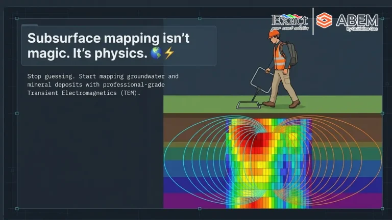
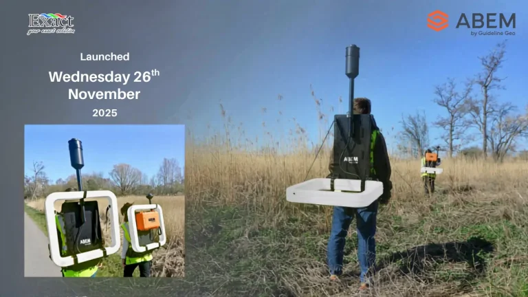
Transform your mineral exploration with the ABEM GroundTEM Trek, distributed by PT. Exact Global Teknologi. This cable-free "Walking TEM" dual-backpack system eliminates heavy line-cutting and slashes setup times from hours to under 10 minutes—delivering real-time subsurface data down to 100 meters. 100% Cable-Free & IP67 Rainproof: Ergonomic 15 kg Tx / 10 kg Rx backpacks built for extreme jungle terrain. Real-Time Inversion: Live pseudo-2D color sections displayed instantly on Android screens. Rapid RKAB Compliance: Map long profile kilometers in days to accelerate MinerbaOne approvals.
Discover the future of mining technology at Con-Mine 2026 Jakarta, taking place from May 20-22, 2026, at JIExpo Kemayoran.
Join 15,000 professionals and 150 exhibitors from 12 countries to explore cutting-edge industry innovations. Partner with PT Exact Global Teknologi to transform your mining operations through advanced slope monitoring sensors, subsurface mapping systems, and digital infrastructure modernization for optimal safety and efficiency.
Revolutionizing Runway Safety: 6D LiDAR & Automated Monitoring
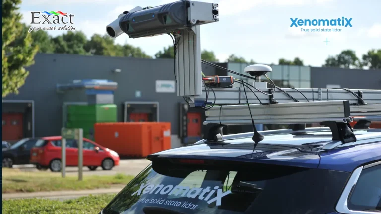
Stop relying on subjective "visual estimates" that jeopardize safety and drain budgets. XenoTrack transforms runway management into an exact science, using True Solid-State LiDAR and Edge-AI to deliver high-precision digital twins without operational interruptions.
Key Performance Benefits:
1. Zero Downtime: Conduct full inspections at speeds up to 120 km/h without closing the runway.
2. Extreme Precision: Achieve elevation accuracy under 0.45 mm, ensuring strict ICAO Annex 14 compliance.
3. Cost Efficiency: Early detection through preventive maintenance saves $6 in future repairs for every $1 spent today.
4. Automated Metrics: Instantly calculate PCI and IRI scores using NVIDIA-powered Edge-AI for objective reporting.
5. Rugged Reliability: IP65-rated hardware with zero moving parts ensures durability in extreme environments.
Transition from manual assumptions to objective mathematical proof. Secure your infrastructure and optimize your budget with the new standard in 6D LiDAR inspection.
Contact PT. Exact Global Teknologi at compro.etinion.com/ for an exclusive consultation.
Selecting a professional geoelectrical service is critical for the success of major projects, requiring uncompromised data accuracy and high-resolution results for tasks such as groundwater prospecting and mineral exploration. This guide highlights the ABEM Terrameter LS 2 as the premier choice in Indonesia, featuring isolated measurement channels with dedicated 24-bit digitizers to prevent signal interference. Key advantages include revolutionary 100% Duty Cycle IP for faster, high-quality data collection and a rugged IP66-rated aluminum casing built to withstand harsh tropical environments. Additionally, its smart technology enables remote monitoring via VNC and instant troubleshooting over a VPN, significantly minimizing project downtime. Backed by PT. Exact Global Teknologi, the official distributor in Indonesia, the system ensures versatile applications across various sectors and exceptional after-sales support.
The ABEM GroundTEM Trek is a revolutionary "Walking TEM" solution designed to help mining companies in Indonesia meet the urgent RKAB 2026 deadlines and strict MinerbaOne reporting requirements. By replacing slow, traditional cable-based methods with a lightweight, backpack-mounted system, this technology enables 10x faster mapping of the subsurface in real time.Key highlights of the system include:Superior Portability: The system is entirely cable-free and worn on the backs of two operators, with the receiver backpack weighing 10 kg and the transmitter backpack weighing 15 kg.Optimized for Nickel Laterite: It accurately maps the complex electrical contrasts between resistive caprock and conductive limonite and saprolite zones at depths of 50 to 100 meters.Real-Time Visualization: Using an Android mobile app, operators can view live pseudo-2D color sections and 1D inversions directly in the field, allowing for immediate geological insights.Rugged Design: Built for extreme Indonesian terrain, the hardware is IP67-rated, making it completely resistant to dust and heavy tropical rain.Operational Precision: A built-in "Coil Distance Regulator" ensures data quality by monitoring the 15-meter operator spacing in real time via visual and audible alerts.Continuous Mapping: The system's dual-moment transmitter and high-density logging allow crews to map hectares of land daily, eliminating zero-value setup time.This advanced geophysical tool, distributed by PT. Exact Global Teknologi, is the ultimate strategy for accelerating exploration and securing mining permits in Indonesia's demanding environments
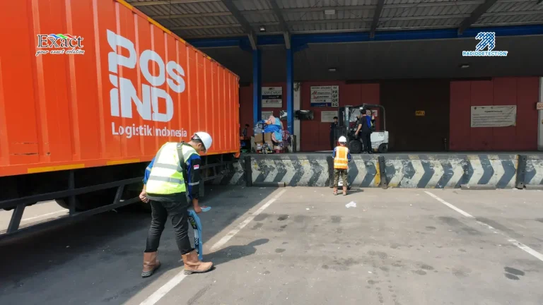
Eliminate blind spots in subsurface utility mapping with the synergy of GPR and the RD8200 series. Learn our proven 3-phase methodology to accurately locate PVC and metallic pipes across Indonesia with PT. Exact Global Teknologi . Click for the full technical guide and equipment solutions backed by an industry-leading 3-year warranty.
The Challenge: Jakarta’s Narrow Paths and "Blind" Maps
Mapping underground infrastructure in dense urban environments like Jakarta is a high-stakes challenge. Existing utility maps are often outdated or inaccurate, and the physical constraints of narrow 1.5-meter sidewalks make traditional mapping methods nearly impossible to execute. In these restricted spaces, construction teams often resort to "blind trenching," which leads to dangerous utility strikes, massive water leaks, and billions of Rupiah in fines.