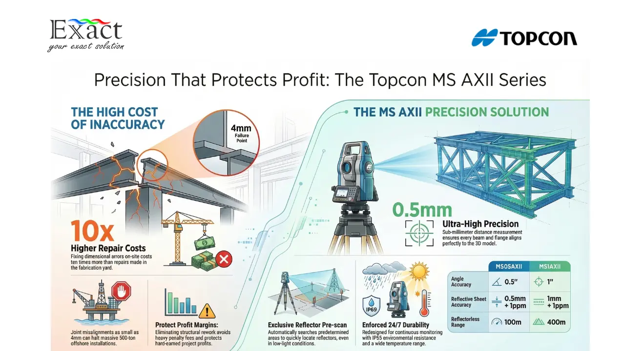
Imagine your team ships a massive 500-ton steel jacket from a fabrication yard to an offshore site in the Java Sea. The heavy lift crane lowers the module, but the connection joints are off by just four millimeters. The entire installation stops. You now face a worst-case scenario: you have to pay for expensive offshore cutting and welding, plus the daily standby rate of the installation vessel. In the heavy infrastructure and oil and gas sectors, a tiny measurement error quickly turns into billions of Rupiah in lost profit. Standard surveying tools simply lack the tight tolerances required to guarantee a perfect fit.
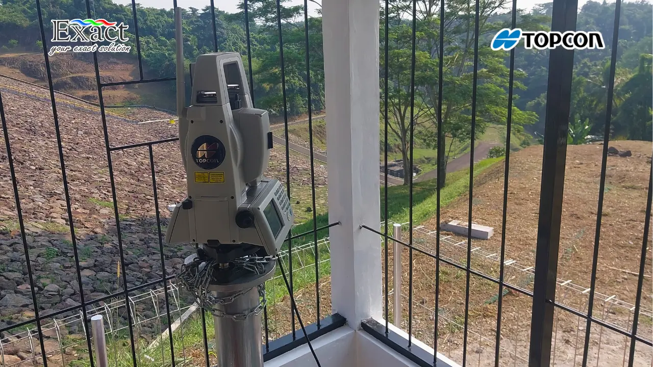
When you look at the math, rework is the most expensive line item on any construction or fabrication project. Fixing a dimensional error offshore or at the final site costs up to ten times more than fixing it back in the fabrication yard. The only proven way to achieve a true “First-Time Fit” is by executing a strict dimensional control survey Indonesia protocol. By deploying the Topcon MS AXII robotic total station, we replace field guesswork with 0.5-millimeter facts. This instrument creates an uncompromising 3D control network, ensuring every pipe spool, flange, and steel beam aligns exactly to the 3D CAD model before it ever leaves your facility.
The return on investment goes far beyond saving materials and labor. When you completely eliminate structural rework, your project stays exactly on schedule. You avoid heavy penalty fees (liquidated damages) for late delivery. Proving to your clients that your QA/QC process relies on 0.5″ precision equipment instantly builds trust and secures future contracts. You stop burning cash on last-minute corrections and start protecting your hard-earned profit margins.
At Exact Global, we help project owners, directors, and geodetic engineering managers achieve zero-rework operations. Here are the top 7 reasons why upgrading your dimensional control strategy with the Topcon MS AXII is the best financial decision you will make this year.
7 Reasons the Topcon MS AXII is the Ultimate Dimensional Control Solution
To prevent expensive misalignments, your QA/QC and engineering teams need tools built specifically for industrial-grade accuracy. Here is how the Topcon MS AXII dominates the field.
1. Sub-Millimeter Accuracy for First-Time Fit
The core goal of a dimensional control survey is making sure components manufactured in different locations fit together perfectly on the first try. The Topcon MS AXII delivers an angular accuracy of 0.5 arc-seconds and a distance accuracy of 0.5 millimeters.
When your engineers measure the bolt hole of a massive turbine or a pipeline flange, this instrument leaves no room for doubt. It captures the exact X, Y, and Z coordinates with microscopic precision. When you bring two massive components together at the installation site, they will slot together perfectly. You completely remove the need for forced fitting, cutting, or re-welding.
2. Establishing Unbreakable Control Networks
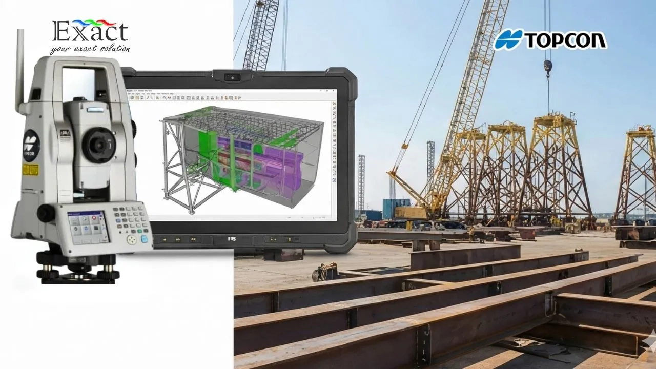
Many modern fabrication yards use 3D laser scanners to capture the “as-built” conditions of their structures. However, 3D scanners alone have a fatal flaw: over long distances across a large yard, their data can drift and lose accuracy.
We solve this by using the Topcon MS AXII to establish a highly precise primary control network. The total station sets the absolute coordinates around the module. The 3D laser scanner then references these exact points. This combination guarantees that your massive point cloud data is tied to a sub-millimeter foundation, giving your executive team complete confidence in the final dimensional report.
3. Matrix Tracking in Harsh Yard Environments
Fabrication yards in Batam, Karimun, or Cilegon are tough environments. They are filled with welding smoke, heavy dust, and blinding sunlight. Standard robotic total stations struggle to find their target prisms in these low-visibility conditions. The machine ends up searching blindly, which wastes your engineers’ time and delays the reporting process.
The MS AXII features advanced Matrix Tracking technology. It uses a specialized algorithm to easily cut through low-contrast environments. Even if there is heavy dust or heat shimmer coming off the hot steel plates, the MS AXII locks onto the dead center of the prism every single time. Your team gets the data faster, without interruptions.
4. Rapid Auto-Correction Against Vibrations
Heavy fabrication yards are never quiet. Massive overhead cranes move steel plates, heavy trucks pass by, and strong coastal winds hit the surveying equipment. These vibrations easily shake the internal compensator of standard total stations, causing bad measurements and false data.
Topcon built the MS AXII with a rapid-response dual-axis compensator. When a heavy crane drops a load nearby and the ground shakes, the instrument instantly detects the micro-vibration. It automatically corrects the laser angle in a fraction of a second before taking the measurement. If the vibration is too high, the system waits until the movement stops. You never have to worry about recording bad data.
5. Automated Deformation Monitoring During Heavy Lifts
When a 1,000-ton steel module is lifted by cranes to be weighed or moved, the sheer weight can cause the steel frame to bend, sag, or permanently deform. If the structure bends out of its design tolerance during the lift, it becomes useless.
We can program the Topcon MS AXII to automatically track specific points on the steel structure during the lifting process. It constantly measures these points in real-time, sending live deflection data to your laptop. If the steel starts bending beyond the safe limit, you can stop the crane immediately before the structure takes permanent damage.
6. Eliminating Human Error in QA/QC
Manual surveying relies on human eyesight. If a surveyor is tired after a 10-hour shift under the hot sun, they might aim the crosshairs slightly off the center of the target. Across a 50-meter module, that tiny human error multiplies into a massive dimensional failure.
Because the Topcon MS AXII is a fully robotic system, it removes human error from the equation. The Auto-Collimation feature automatically aims the laser at the exact mathematical center of the prism. Whether your team surveys the module at 8 AM or 11 PM, the measurement routine is mathematically perfect every single time.
7. Instant Clash Detection Reporting
In the offshore and petrochemical industries, you often have to install new pipe spools into an existing, tightly packed facility. If the new pipe is just a few millimeters too long, it will crash into existing structures.
By conducting a dimensional control survey Indonesia with the Topcon MS AXII, your engineering team can capture the exact dimensions of both the new pipe and the existing facility. They overlay this data against the 3D CAD model on their computers. They can instantly spot any physical clashes on the screen before the pipe ever leaves the yard. You fix the problem on a computer screen for free, instead of fixing it with a blowtorch offshore for millions of Rupiah.
As an executive, you know that hope is not a strategy. You cannot afford to hope that a multi-million dollar steel structure will fit when it arrives at the project site. You need absolute, documented certainty.
Upgrading your QA/QC workflow from standard surveying tools to the Topcon MS AXII is the fastest way to eliminate rework, protect your project timeline, and secure your profit margins. At Exact Global, we supply the equipment, the technical support, and the geodetic expertise to help your company achieve First-Time Fit on every single project.
Do not leave your next major fabrication project to chance. We have created an exclusive resource for EPC contractors and project owners to calculate their exact risk exposure.
Are you ready to see the equipment in action?
Schedule a private technical audit and live demonstration of the Topcon MS AXII with our Lead Geodetic Engineer. We will review your current QA/QC workflow and show you exactly where we can cut costs.
✉️ Email: marketing@exactglobal.co.id
📞 WhatsApp: +62 812-9252-3900
Frequently Asked Questions (FAQ)
1. Is the Topcon MS AXII certified for strict oil and gas dimensional control standards?
Yes. The MS AXII is recognized globally as an industry-standard instrument for high-precision metrology. Its 0.5″ angular accuracy and 0.5 mm distance accuracy easily meet and exceed the strict tolerance requirements demanded by international oil and gas operators and EPC contractors.
2. We already use 3D Laser Scanners. Why do we need this Total Station?
3D laser scanners are excellent for capturing massive amounts of surface data quickly. However, over large areas (like a 100-meter fabrication yard), point cloud data can warp or drift. The Topcon MS AXII is required to set up a rigid, highly accurate primary control network. You tie your scanner data to this network to ensure the entire 3D model remains perfectly accurate from end to end.
3. Does our current survey team need special training to use this equipment?
While the technology inside the MS AXII is highly advanced, the user interface operates similarly to standard Topcon instruments. However, dimensional control requires specific field methodologies. When you acquire the instrument through Exact Global, our geodetic experts provide comprehensive handover training to ensure your QA/QC team knows exactly how to maximize the sub-millimeter features.
4. How does this system handle the harsh weather of Indonesian fabrication yards?
Topcon built the MS AXII specifically for heavy industrial use. It carries a high IP rating for dust and water resistance, meaning it performs flawlessly in the high humidity, salty coastal air, and sudden rainstorms common in Indonesian shipyards and fabrication facilities.
5. How quickly can we get a return on investment (ROI) from this instrument?
The ROI is typically realized on the very first major error it prevents. The cost to deploy an offshore welding crew and hold an installation vessel on standby for just three days usually costs far more than the entire purchase price of the Topcon MS AXII. By ensuring a First-Time Fit on your first major module, the instrument pays for itself immediately.


