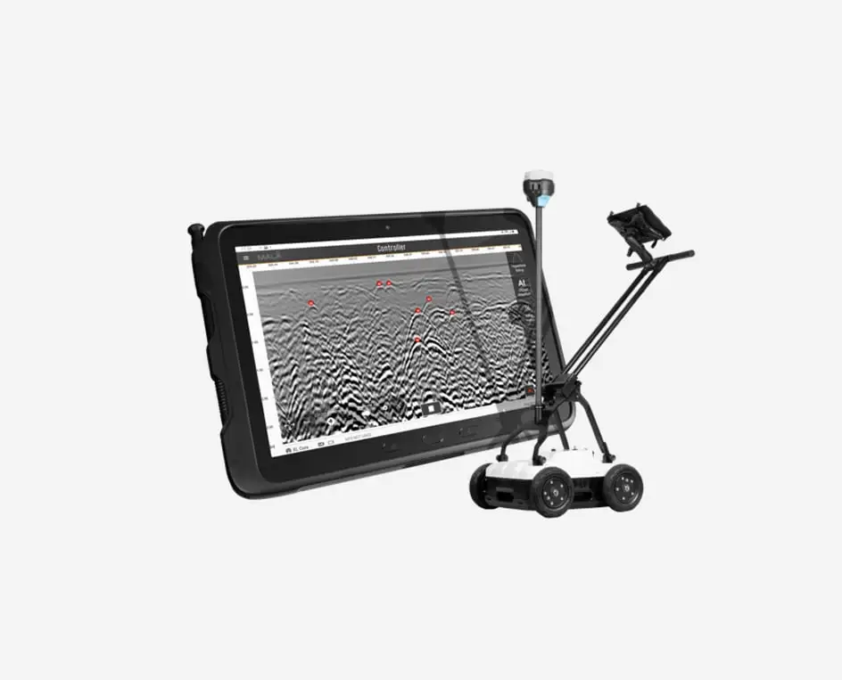
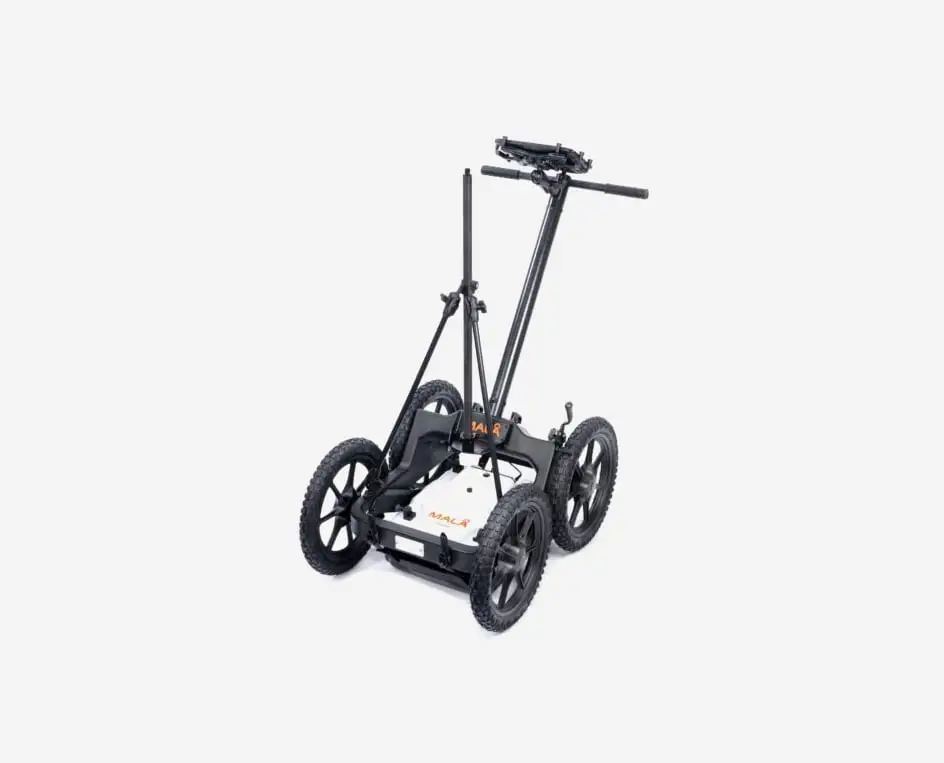
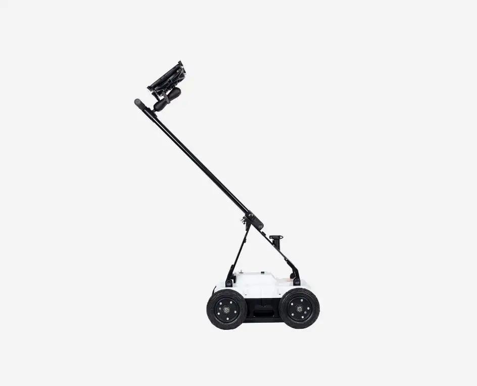
MALÅ Easy Locator Core

Home > MALÅ Easy Locator Core

Tentang Produk

MALÅ Easy Locator Core

MALÅ Easy Locator Core The Intelligent Ground Penetrating Radar for Utility Professionals.

The MALÅ Easy Locator Core is the definitive, intelligent Ground Penetrating Radar (GPR) solution for utility locating professionals, engineered to be intuitive for beginners while offering the comprehensive capabilities required by experts. Representing the evolution of the industry-standard Easy Locator series established two decades ago, this premium, Swedish-built system reflects Guideline Geo’s commitment to customer-centric innovation and cutting-edge research. By combining advanced subsurface detection technology with a user-friendly design, the Easy Locator Core sets a new global benchmark for performance, accuracy, and reliability in modern utility mapping.

Intelligent Real-Time Interpretation

The World’s First Smart GPR Support for Utility Locating

Real-time support via MALÅ AI represents a revolutionary breakthrough in the world of GPR. The MALÅ Easy Locator Core stands as the world’s first product to utilize intelligent real-time interpretation for utility locating. In the field, all markers established by MALÅ AI can be instantly converted into standard markers with local utility color codes. This feature provides invaluable guidance for less experienced users while simultaneously accelerating the interpretation process for experts, resulting in significant time savings on every project.

Aplikasi Pengendali MALÅ

Pemasangan cepat di lapangan dan aplikasi seluler yang ramah pengguna memudahkan penggunaan GroundTEM i-Series

Gulung kumparan penerima, lalu lingkaran pemancar, dan sambungkan keduanya ke instrumen. Tidak ada cara yang benar atau salah untuk meletakkan kumparan ini; mereka tidak bersifat arah. Sebagai alternatif, sambungkan bingkai pengangkut dan pasang kabel untuk Explorer Coils, lalu sambungkan pelindung tegangan ke casing instrumen.

Kemudian, jalankan aplikasi GroundTEM, pilih garis survei dan nomor stasiun, lalu ikuti petunjuk di layar untuk memilih skrip pengukuran. Sistem siap digunakan: pilih durasi pengukuran yang diinginkan dan tekan tombol “play”.

Lihat data masuk secara langsung dan bahkan pilih opsi untuk memanfaatkan inversi real-time (tersedia pertengahan 2025) untuk melihat hasil yang diproses secara instan.

MALÅ Controller App

MALÅ Vision

Perangkat lunak pemrosesan untuk Easy Locator Core

MALÅ Vision adalah perangkat lunak pemrosesan GPR yang mudah digunakan untuk mengelola data GPR, dikembangkan untuk digunakan di semua perangkat oleh semua jenis pengguna GPR. MALÅ Vision dilengkapi dengan MALÅ AI untuk dukungan interpretasi otomatis dan fitur-fitur kuat lainnya seperti polylines otomatis. MALÅ AI yang terintegrasi dalam perangkat lunak pemrosesan pasca-pengolahan berbasis cloud MALÅ Vision akan memberikan dukungan tambahan dengan menganalisis penanda dan menunjuk lokasi pipa dan kabel yang mungkin ada dalam dataset Anda. Dokumentasikan semua aset yang tertanam. Lihat hasil Anda di Google Maps atau OpenLayers, gunakan gambar satelit atau Street View (pandangan orang pertama) dari lokasi Anda. Ekspor hasil Anda sebagai peta cetak, DXF, atau KMZ untuk berbagi dengan mudah.

Application Area
Features
Resources
  • Utility Locating : Effectively detect and trace buried infrastructure including metallic and non-metallic pipes, cables, fiber optics, and concrete conduits.
  • Damage Prevention : Rapidly scan excavation sites to identify hidden hazards and avoid costly utility strikes during construction and trenching projects.
  • Subsurface Mapping : Create detailed digital records of underground assets for accurate project planning, documentation, and infrastructure management.
  • MALÅ HDR Technology, unmatched resolution and depth for superior data clarity.
  • Real-time MALÅ AI, instant automated interpretation during data collection.
  • Cloud-Connected Workflow, instant processing and global data sharing via MALÅ Vision.
  • Ultra-Portable Design, world’s most lightweight and foldable professional GPR.
  • Rugged All-Terrain Build, Swedish-engineered durability for the toughest environments.
  • Wireless Acquisition, Full cable-free operation for maximum field mobility.
  • Precision Georeferencing, seamless integration with high-accuracy RTK GNSS.
Translate »