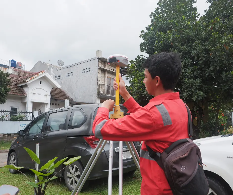
Precision surveying in Indonesia now depends a lot on GNSS RTK and IMU tilt sensors. The ComNav N3 is a top-notch GNSS RTK device with an IMU tilt sensor. It aims to change the game in the field. We’ll see how well it works in real situations.
Why Choose The ComNav N3?
We understand the challenges you face in the field. Here is why the ComNav N3 is the exact solution for your surveying needs:
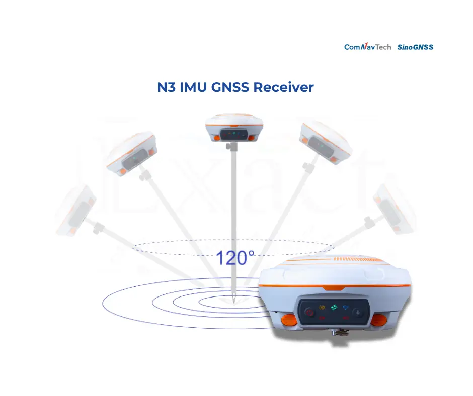
- True Tilt Compensation: Our integrated IMU tilt sensor allows you to measure points without holding the pole perfectly vertical, correcting for tilt and orientation automatically up to 120°.
- Field-Ready Ruggedness: The N3 built with a tough design specifically to handle tough surveying jobs and rugged terrain.
- Superior Signal Management: With multi-constellation support and advanced signal processing, our device tracks more satellites and cuts down multipath interference effectively.
The Advantages:
- Work Faster & Smarter: The N3 eliminates the need for precise leveling, which significantly saves time and boosts your overall productivity.
- Reduce Physical Fatigue: By removing the constant need to check the bubble level, our technology reduces the physical demands of surveying work, keeping you efficient all day.
- Unstoppable Accuracy: Whether in tough spots or uneven terrain, our GNSS RTK technology ensures you get centimetre-level positioning accuracy every time.
The ComNav N3 at a Glance: Key Specifications & Advanced Features
The ComNav N3 is a top-notch GNSS RTK receiver that has changed the surveying world. It is packed with advanced specifications to ensure it meets the highest professional standards:
- GNSS RTK Technology: Gives precise location data with centimetre-level accuracy.
- IMU Tilt Sensor: Boosts accuracy in tough spots and allows for tilt adjustment, supporting up to 120° tilt survey without calibration.
- Advanced GNSS Engine: Capable of tracking 50+ satellites simultaneously across all major constellations (GPS, GLONASS, Galileo, BeiDou, QZSS), ensuring you lock a “Fixed” solution faster, even under tree canopies or in urban canyons.
- Global Connectivity with L-Band & PPP: We ensure you are never out of range. With L-Band support and PPP (Precise Point Positioning) features.
- Long-Range Internal UHF: Our enhanced internal radio supports a longevity range up to 15km.
- All-Day Battery Life: The N3 is engineered with high-capacity power management, delivering up to 25 hours of continuous operation.
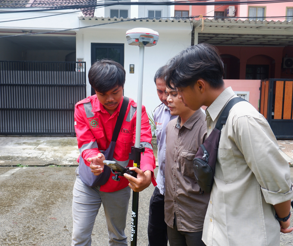
- Powerful Web UI: Our user-friendly Web UI allows you to access the receiver via WiFi to easily download static data and upgrade firmware wirelessly—no cables or complex software required.
Its features and tough design make the ComNav N3 perfect for tough surveying jobs.
Understanding GNSS RTK Technology
GNSS RTK technology is key to understanding its role in precision surveying. It stands for Global Navigation Satellite System Real-Time Kinematic. This tech offers high-precision location data. It’s used a lot in surveying, mapping, and other tasks needing exact positioning.
How RTK Works
RTK technology uses a network of reference stations. These stations send correction data to receivers like the ComNav N3. This data lets the receiver pinpoint its location with centimeter accuracy.
The process involves complex algorithms. These algorithms adjust for errors like satellite signal delay and atmospheric interference.
Benefits of RTK for Precision Surveying
The advantages of RTK in precision surveying are many. It boosts the accuracy of measurements, cutting down on manual adjustments and errors. This tech also speeds up work by offering real-time data. Surveyors can make fast, informed decisions.
| Benefits | Description |
| High Accuracy | Centimetre-level positioning accuracy |
| Increased Productivity | Real-time data for quicker decision-making |
| Reduced Errors | Minimizes manual adjustments and errors |
The IMU Tilt Sensor Advantage
In the world of precision surveying, the ComNav N3’s IMU tilt sensor is a game-changer. It offers unparalleled accuracy and efficiency. This technology is changing how surveyors work, making it easier to get high-precision results in tough environments.
What is an IMU Tilt Sensor?
An IMU (Inertial Measurement Unit) tilt sensor is a sophisticated device. It measures the orientation and tilt of the GNSS receiver. It uses accelerometers and gyroscopes to give accurate measurements of the receiver’s position and orientation.
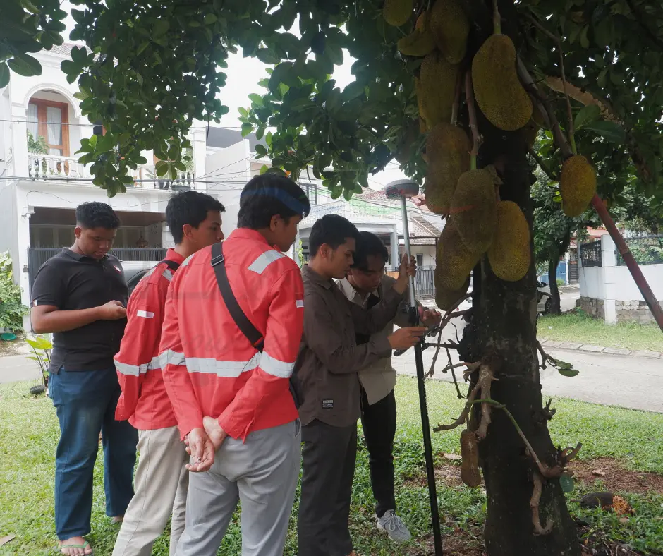
This information is key for precise GNSS RTK measurements, especially when the receiver is not perfectly level. The IMU tilt sensor technology lets surveyors take measurements without needing to level the receiver exactly. This saves time and reduces the physical demands of surveying work. It’s especially helpful in rugged or uneven terrain where traditional leveling methods are impractical.
FAQ
What is the ComNav N3, and what is it used for?
The ComNav N3 is a device for precise surveying and mapping. It has a GNSS RTK receiver and an IMU tilt sensor.
How accurate is the ComNav N3?
The ComNav N3 is very accurate. It matches the performance of top GNSS RTK devices, even in tough conditions.
What is the benefit of using an IMU tilt sensor in surveying?
The IMU tilt sensor makes surveying faster and more accurate. It corrects for tilt, so you don’t need to hold the device perfectly level.
Is the ComNav N3 compatible with existing software?
Yes, the ComNav N3 works with many software solutions. It also exports data in different formats.
What kind of support does ComNav offer for the N3?
ComNav offers warranty, technical support, and training for the N3. This ensures customers get help when they need it.
How does the ComNav N3 perform in challenging environments?
Our tests showed the ComNav N3 works well in tough conditions. It keeps its accuracy and reliability.
What are the key features of the ComNav N3?
The ComNav N3 has a GNSS RTK receiver and an IMU tilt sensor. It’s built for precise surveying and mapping, with a strong design and easy-to-use interface.
Is the ComNav N3 available in Indonesia?
Yes, the ComNav N3 is available in Indonesia. It comes with local support options. Contact our marketing at marketing@exactglobal.co.id or Whatsapp +62 812-9252-3900.
How does the ComNav N3 compare to other GNSS RTK devices?
The ComNav N3 has competitive features and performance. It’s a good choice for surveying professionals.


