ABEM GroundTEM (Ralli)

Home > ABEM GroundTEM Ralli

Tentang Produk

GroundTEM Ralli Groundwater Mapping Solutions for Rapid Large-Area Surveys

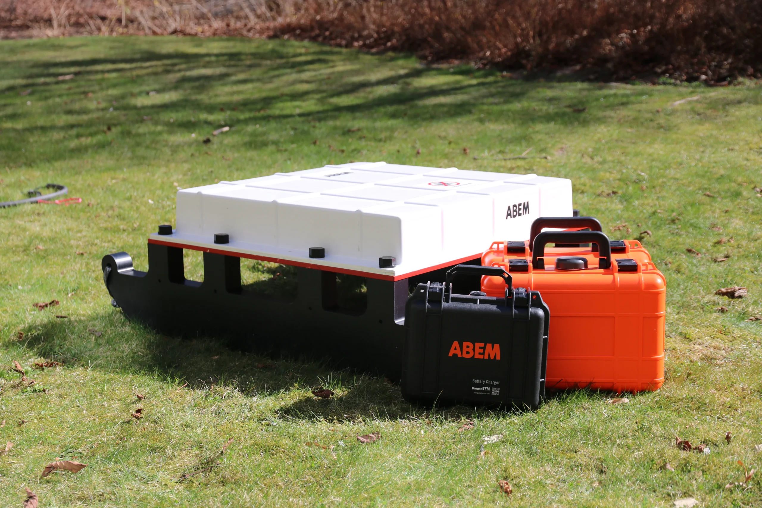
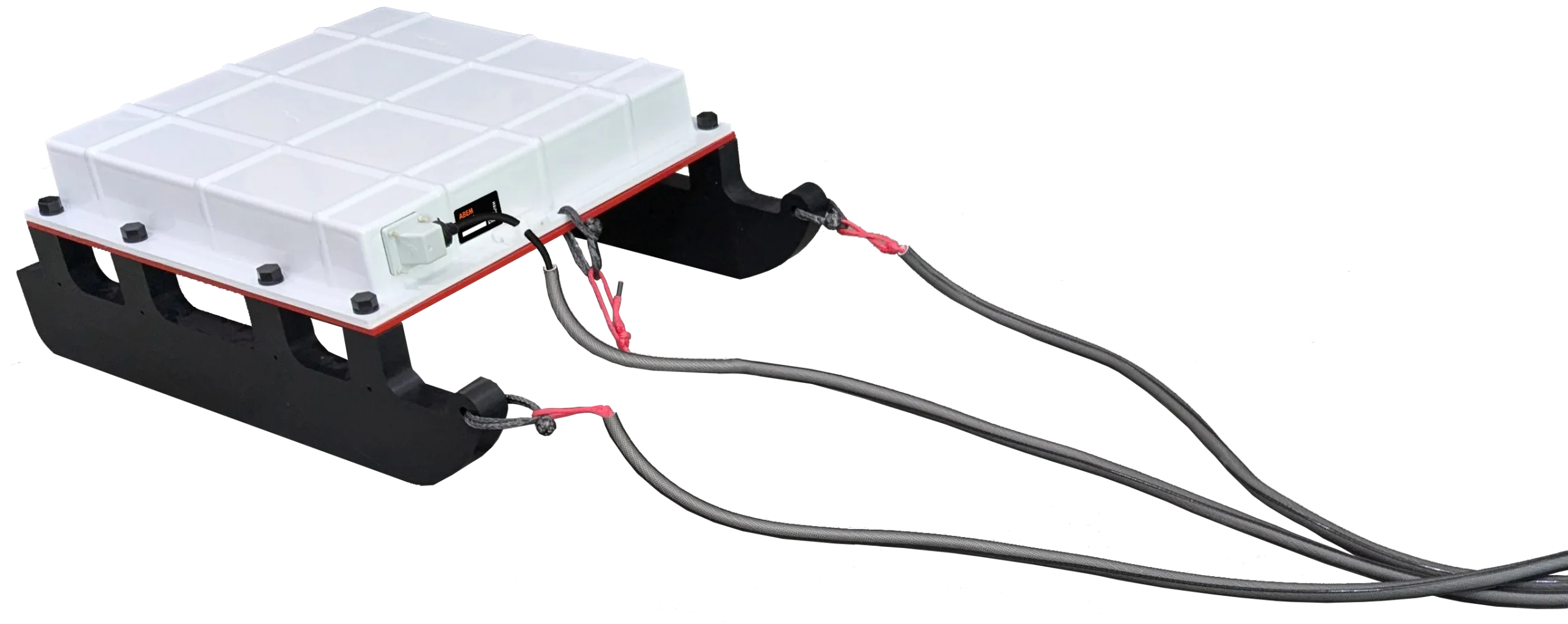
GroundTEM Ralli groundwater mapping is a mobile transient electromagnetic (TEM) solution designed for fast, accurate, and large-scale subsurface investigations. Part of the ABEM GroundTEM platform, GroundTEM Ralli enables efficient groundwater and environmental mapping by combining high-speed TEM acquisition with reliable positioning and quality control.

Developed in collaboration with TEMcompany, GroundTEM Ralli delivers high-resolution resistivity data with investigation depths of up to 200 meters, providing essential insights into aquifer systems, geological structures, and environmental conditions. The system is optimized for rapid coverage, making it ideal for regional groundwater mapping and time-efficient survey campaigns.

Efficient TEM Surveying for Groundwater and Environmental Studies

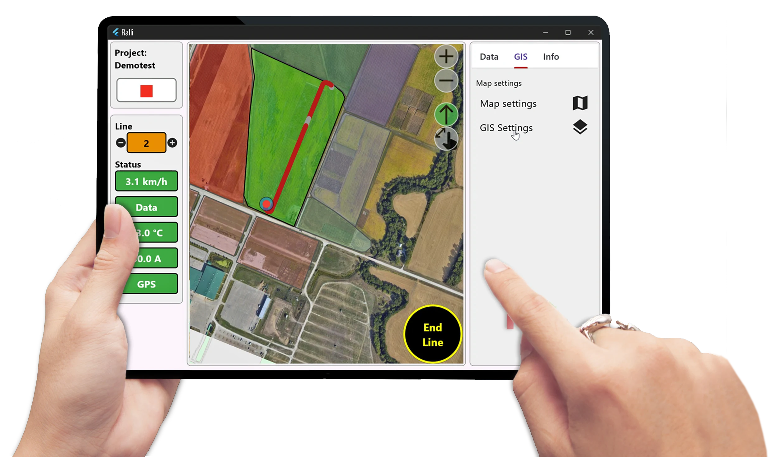
GroundTEM Ralli is engineered for professionals who require dependable data quality while covering large survey areas in a short time. Its mobile configuration streamlines field operations, reducing survey complexity and total project duration without compromising data reliability.

Widely used in groundwater mapping, environmental investigations, and geological mapping, GroundTEM Ralli supports informed decision-making in water resource assessment, hydrogeological studies, and regional exploration projects.

Transforming survey for groundwater and environmental studies

Towed by a quad bike, the GroundTEM Ralli efficiently surveys anything from a single profile to an entire landscape, providing detailed subsurface images. The system’s transmitter configuration is adaptable, allowing a choice of compact footprint or deep survey with data provided from just a metre below the surface down to 180 – 200 m. The relatively compact nature of the hardware makes shipping the system and taking it to the field particularly easy, especially for the volume of data it can return in even a short field campaign. This versatility makes the Ralli an invaluable tool for various applications such as mapping recharge pathways, helping to site wells more reliably, or studying the impact of saline intrusion.

Schematic layout

The different Tx configurations define the system capabilities: 2 × 2 × 1 is a compact loop providing good depth (maximum ~100 m) but with a reduced footprint for easier deployment; 3 × 3 × 1 is the standard loop for regular sounding depth (maximum ~130 m); 3 × 3 × 3 is a multi-turn coil for deeper surveys (~180 – 200 m).

Spesifikasi Teknis Terpilih

Application Area
Features
Resources
  • Rapid Groundwater Mapping: Ideal for large-scale aquifer mapping and delineating salinity interfaces while moving, significantly increasing productivity.

  • Geological Profiling: Efficiently map clay layers, bedrock depth, and stratigraphic variations over vast areas in a fraction of the time compared to static systems.

  • Environmental Monitoring: Fast detection of groundwater contamination plumes and monitoring of saline water intrusion across extensive coastlines.

  • Infrastructure Planning: Rapidly assess ground conditions for large-scale engineering projects like pipelines, roads, or railway corridors.

  • Continuous"On-the-Go" acquisition, specifically designed for towed TEM surveys. Data collection at speed up to 30km/h.
  • Dual-moment measurement.
  • High-speed sampling.
  • Integrated towing solution.
  • Real-time data visualization.
  • Rugged and weatherproof.
  • Precise georeferencing, high-accuracy integrated GPS.
  • Modular configuration.
Translate »