We are highly enthusiastic about welcoming Con-Mine 2026 Jakarta, an exhibition that has become a center of attention for the construction and mining industries. As industry players, we view this event not merely as a regular promotional event, but as a golden opportunity to witness the future of mining technology first-hand. Through the CON-MINE 2026: Indonesia International Construction, Infrastructure and Mining Exhibition, we will witness how innovation can transform the way we work in the field.
This prestigious exhibition was organized by GEM Indonesia and took place from May 20–22, 2026, at Jakarta International Expo (JI-Expo) Kemayoran, Jakarta, Indonesia. Building on the success of the previous edition, the event returned on a larger and better scale to meet the rapidly growing demands of the construction and mining industries.
Here is a list of the main reasons why this event is so important, and how modern technology will become the primary foundation for all of us:
An Impressive Exhibition Scale for Business Expansion
For us, the size of an exhibition greatly determines the scale of networking opportunities that can be built. Con-Mine 2026 Jakarta is projected to feature 150 exhibitors from 12 different countries. This event targets an attendance of 15,000 visitors and will occupy an exhibition area of 8,000 square meters. This massive scale ensures that we, as industry professionals, can find a variety of specific needs, meet directly with industry leaders, and explore the latest product and service innovations.
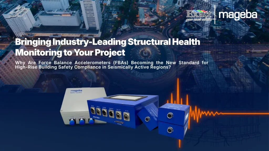
The Need for Slope Monitoring Sensors
Safety is our utmost priority in the mining area. Therefore, the introduction and use of slope monitoring sensors is highly vital. This technology allows us to monitor ground movement and slope stability in real-time. With accurate early warnings, the risk of landslides can be significantly minimized so that mining operations remain safe for all workers.
The Sophistication of Subsurface Mapping Systems
The application of a sophisticated subsurface mapping system greatly helps us see geological structures with a much higher level of accuracy. This technology has proven capable of reducing the risk of drilling failures and ensuring that natural resource extraction is carried out in the most measurable way.
The Drive Towards Digital Infrastructure Modernization
Digital infrastructure modernization is no longer just an option, but an absolute necessity for us to remain competitive. The utilization of wireless internet networks in remote locations, cloud-based data processing, and interconnected devices makes it easier for us to monitor our entire heavy fleet remotely.
Realizing Mining Operational Efficiency Solutions
By integrating digital systems and modern monitoring tools, we are able to present mining operational efficiency solutions that have a direct impact on reducing operational costs. This efficiency can be seen from fuel savings, minimized machine downtime, and increased daily productivity.
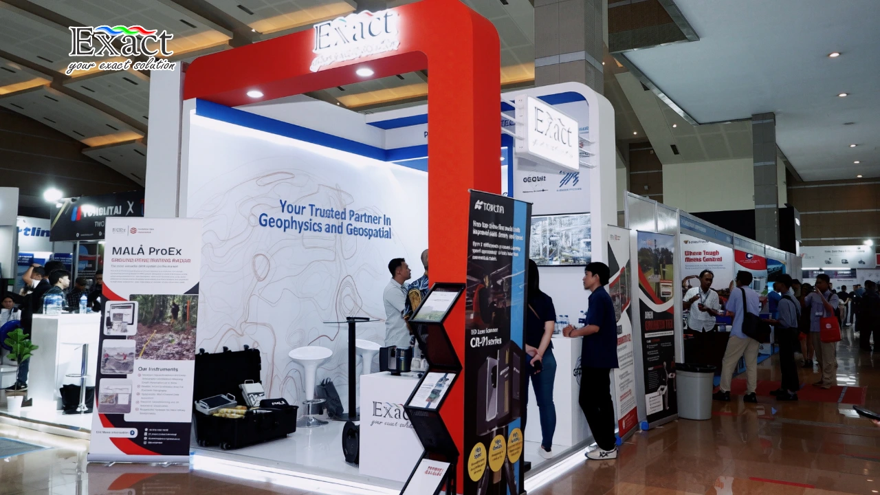
Getting to Know PT. Exact Global Teknologi Closer
In facing modern mining challenges, PT. Exact Global Teknologi is here as a strategic partner ready to assist us. We focus entirely on providing software, smart analytical systems, and monitoring hardware specifically designed to survive in extreme mining environmental conditions. Our services include the provision of cutting-edge geotechnical instruments, high-accuracy sensor installations, to user training. With us, the transformation towards safe, digital, and efficient mining operations is a certainty.
Contact Us: Let’s build a better future for the Indonesian mining industry. For further technical discussions regarding our services, please reach our team through the contacts below:
- Website: ww3.exactglobal.co.id
- Email Marketing: marketing@exactglobal.co.id
- WhatsApp: +62 812-9252-3900
Frequently Asked Questions (FAQ)
-
When and where exactly will the Con-Mine 2026 Jakarta exhibition be held?
This heavy equipment, service, and mining technology exhibition took place from May 20–22, 2026, at Jakarta International Expo (JIExpo) Kemayoran, Jakarta, Indonesia.
-
What is the main function of slope monitoring sensors?
Its main function is to monitor soil or rock stability continuously (real-time) to provide early warning if there is a potential for landslides, so that we can secure the mining area before an accident occurs.
-
How can PT. Exact Global Teknologi help our mining operations?
We provide various integrated technological instruments, ranging from subsurface mapping systems, digital infrastructure modernization, to monitoring tools, all specifically designed to deliver safe and cost-effective mining operational efficiency solutions. You can contact us directly via email at marketing@exactglobal.co.id or via WhatsApp at +62 812-9252-3900.