The Operational Reality: That Moment of Hesitation
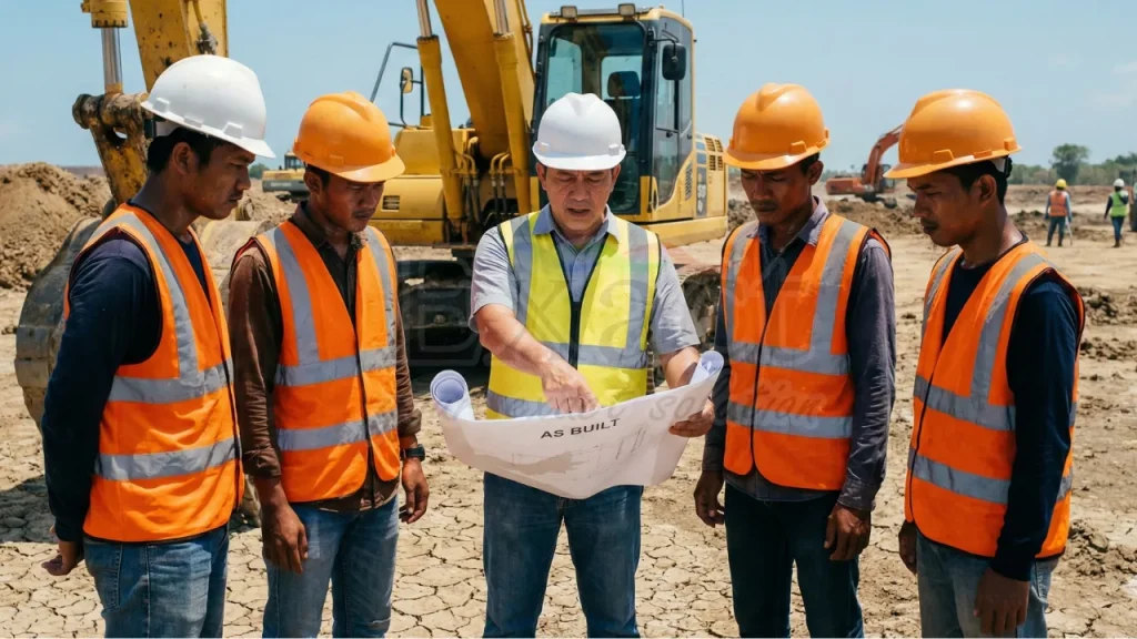
Every site manager in Indonesia recognizes the scenario. It is 2:00 PM, the heat is intense, and the excavator is idling. The operator looks at you, waiting for the signal to break ground.
In your hand, you have a set of “As-Built” drawings that declare the area clear. Yet, you know the reality of the field: those drawings date back to 1995. Since then, three different contractors have worked on this road. The drawings represent intent, not necessarily reality.
You know that if the bucket strikes a high-voltage cable or a gas line, the consequences go far beyond a stopped project or an exploded budget. Most importantly, people could get hurt. That moment of hesitation—that operational uncertainty—is what we call “Blind Digging.”
In 2026, we no longer need to accept that risk. We are witnessing a massive shift in how our industry operates. Adopting GPR as the industry standard for utility detection isn’t just a compliance rule written in a contract; it is the only way to ensure peace of mind when managing complex excavations.
At PT. Exact Global Teknologi, we spend our days in the field alongside you. We understand the noise, the pressure, and the soil conditions. This is the story of how we are changing the way we dig, one scan at a time.
The Challenge: Moving Beyond “Guesswork”
We must be honest about the ground beneath our feet. In dense urban centers like Jakarta and Surabaya, or in the mining belts of Kalimantan, the subsurface is chaotic.
We are dealing with layers of history: colonial-era drainage systems, forgotten telephone cables, and modern fiber optics, all woven together. To complicate matters, the soil in Indonesia is challenging—often consisting of wet, heavy, conductive clay.
For a long time, the industry relied on basic tools. Metal detectors were used, which are excellent for conductive metals but useless for plastic PVC pipes or concrete culverts. Others used entry-level radar units that simply displayed a screen full of static “noise” the moment they encountered wet soil.
Faced with unreliable data, many teams reverted to the old methodology: digging a test pit every 50 meters and hoping nothing existed in the gaps between. But in modern infrastructure, hope is not a strategy.
Case Study: The Gas Line That “Wasn’t There”
Recently, we were deployed to a site in West Java where a contractor was widening an industrial access road. The stakes were high, as the road ran parallel to a major factory zone. The official drawings showed a gas pipe running in a straight line, exactly 1.5 meters deep. The Project Manager was skeptical. “I’ve been working in this area for ten years,” he noted. “Nothing here runs perfectly straight.”
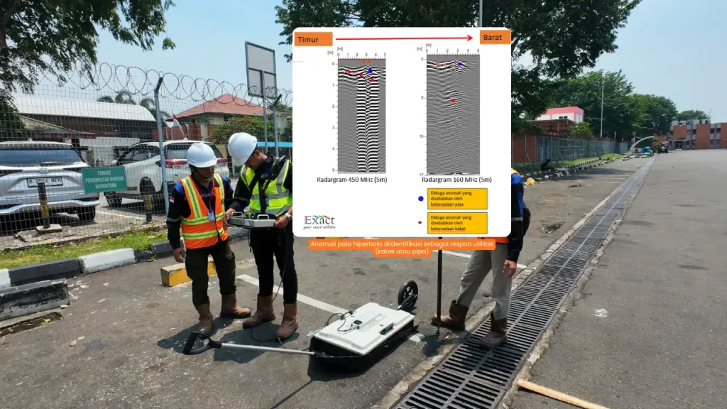
Instead of excavating based on the map, we deployed the MALÅ GroundExplorer (GX). We didn’t just walk a single line; we scanned a grid to create a 3D understanding of the subsurface. We utilized the MALÅ unit specifically for its HDR (High Dynamic Range) capability.
The HDR Advantage: Think of standard radar like trying to hold a conversation in a crowded nightclub; you can hear noise, but you cannot distinguish the words. MALÅ’s HDR technology is akin to putting on noise-cancelling headphones. It suppresses the background “static” of the conductive clay, allowing us to clearly detect the faint “whisper” of the pipes below.
The Discovery: On the controller screen, where the map indicated a straight pipe, the MALÅ data showed a clear, arch-shaped reflection (a hyperbola) shifting sharply to the left.Investigation revealed that five years prior, a repair crew had diverted the pipe around a concrete foundation. This deviation was never updated on the maps.
Had the team trusted the drawing and dug straight, the excavator would have ruptured a live gas line. Instead, we marked the actual location on the pavement. When the operator carefully exposed the pipe, it was exactly where the MALÅ data indicated—two meters to the left of the drawing. The relief on the team’s faces was palpable. That is what “Zero Accident” looks like. It is boring. It is quiet. And it ensures everyone goes home safe.
Why We Partner with MALÅ
As the sole distributor for Guideline Geo and MALÅ in Indonesia, we approach this not just as vendors, but as geophysicists. We champion MALÅ because it addresses the specific engineering challenges we face in this region:
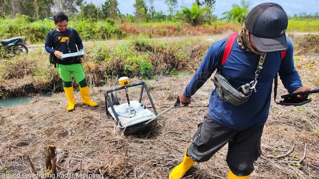
1. Engineered for High-Conductivity Environments Indonesia is humid, and our soil is conductive. Many radar systems fail to penetrate this. MALÅ is built with a wider bandwidth specifically designed to punch through these conductive layers better than any other system we have tested.
2. Operational Efficiency You do not need a PhD to operate a MALÅ GX. We train site engineers to use it effectively in a matter of days. The interface is intuitive, and with connectivity features, you can visualize your position on Google Maps in real-time while you scan.
3. Field Durability We know how equipment is treated in the field—transported in the back of trucks, covered in mud, and exposed to tropical rain. These units are ruggedized (IP65 rated) with a unibody design. There are no loose cables to snag or fragile parts exposed to the elements.
Making Safety the Standard
We are seeing a regulatory transformation. Institutions like PUPR and ESDM are increasingly demanding higher quality subsurface data. They realize that establishing GPR as the industry standard for utility detection is the only path to modernizing our infrastructure.
But beyond regulations, this is about professional integrity. When you scan before you dig, you communicate to your client and your crew: “We care about precision.”
We are moving away from the era where hitting a utility was considered “bad luck.” With the technology available today, striking a pipe is a choice—and it is an avoidable one.
Let’s Dig Smarter
At PT. Exact Global Teknologi, our role extends beyond simply delivering equipment. We are here to empower your team to read the ground. We want to be the technical partner you call when site conditions become difficult.
Let’s eliminate the blind digging. Let’s remove the operational anxiety.
If you are ready to see what truly lies beneath your project site, we invite you to collaborate. We will bring the technology, you bring the project challenges, and together, we will ensure a safe excavation.
PT. Exact Global Teknologi Sole Distributor of Guideline Geo / MALÅ in Indonesia Safe. Accurate. Professional.


