MALÅ Ground Explorer

Home > MALÅ Ground Explorer

About Product

MALÅ Ground Explorer

MALÅ Ground Explorer (GX) – High-Performance Modular GPR Solution

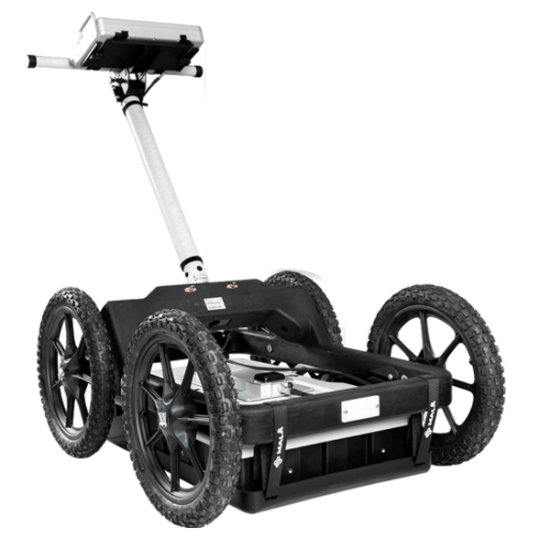
The MALÅ Ground Explorer (GX) is an integrated, high-performance GPR solution designed for a wide range of professional subsurface investigations. Built on MALÅ’s acclaimed High Dynamic Range (HDR) platform, the GX system delivers exceptional data quality, unrivaled depth penetration, and sharp data resolution.

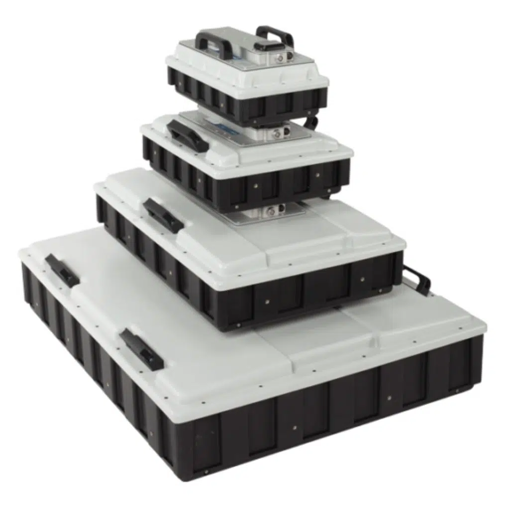
Its fully modular design allows operators to quickly switch between different shielded antennas to match specific project depth and resolution requirements, making it the ultimate tool for geology, engineering, and environmental studies.

mala-gx750-antenna

Unmatched Subsurface Resolution with HDR Technology

Deep penetration meets exceptional clarity

The MALÅ Ground Explorer is powered by proprietary High Dynamic Range technology, which utilizes 32-bit data output to drastically reduce background noise. This results in cleaner GPR profiles, better signal penetration in challenging soils, and the ability to visualize deep stratigraphy and small targets simultaneously.

Unlike conventional GPR systems, the GX system utilizes a lightweight, wireless or single-cable interconnect between the antenna and the control unit. This eliminates complex field wiring, speeds up assembly, and reduces the risk of cable failure in rugged environments.

Flexible Antenna Options for Every Depth Target

Customize your MALÅ GX system with four interchangeable shielded antennas to optimize your survey results:

  • GX750 (750 MHz): High-resolution imaging for shallow applications, concrete scanning, and topsoil forensics (Depths up to 1.5m).

  • GX450 (450 MHz): The ultimate all-rounder for utility mapping, shallow archaeology, and engineering site assessments (Depths up to 3m).

  • GX160 (160 MHz): Optimized for medium-depth geological mapping, bedrock profiling, and environmental studies (Depths up to 7m).

  • GX80 (80 MHz): Designed for maximum depth penetration in deep geological structures, sinkhole detection, and deep water table mapping (Depths up to 15m+).

Optional Accessories & Configurations

MALÅ GroundExplorer (GX)

MALÅ GroundExplorer (GX)

Application Area
Features
Downloads
  • Utility Mapping: Accurately locate and trace metallic and non-metallic utilities such as pipes, conduits, and fiber optic cables with high-definition clarity.

  • Geological Profiling: Map soil stratigraphy, detect bedrock depth, and identify geological structures or sinkholes with deep-penetrating HDR technology.

  • Infrastructure Inspection: Assess the condition of roads, runways, and bridges to detect voids, delamination, or reinforcement details.

  • Archaeological Surveys: Non-destructively locate buried foundations, artifacts, and historical structures while preserving the site's integrity.

  • MALÅ HDR Technology, delivers industry-leading data resolution and significantly deeper penetration than conventional GPR systems.
  • Wireless Acquisition, uses a stable Wi-Fi connection for cable-free operation, reducing setup time and enhancing field safety.
  • Modular Antenna Choice, supports four different antenna frequencies (80, 160, 450, and 750 MHz) to balance depth and resolution requirements.
  • Low Power Consumption, engineered for efficiency, providing a full day of field operation on a single battery charge.
  • High-Precision GPS, full integration with internal and external GNSS/RTK systems for centimeter-level georeferencing of data.
  • Cloud Connectivity, direct integration with MALÅ Vision for real-time data upload, instant processing, and remote team collaboration.
  • Ruggedized Design, Swedish-built quality with a durable, lightweight housing designed for the toughest all-terrain environments.
  • Intelligent Interface, features an intuitive controller app with automated tools like Object Mapper for rapid field reporting.
Translate »