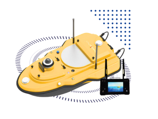
SV600 Unmanned Surface Vessel
An autonomous hydrographic survey boat designed for safe, high-efficiency bathymetric mapping in rivers, lakes, reservoirs, and coastal waters.
Geophysical instruments from ABEM and MALÅ, available to buy or rent with local training and support.
An autonomous hydrographic survey boat designed for safe, high-efficiency bathymetric mapping in rivers, lakes, reservoirs, and coastal waters.
TOPCON – LN 160 The Topcon LN-150 Layout Navigator bridges the gap between digital design and the physical job site. It is the world’s first 3D layout tool designed specifically for construction verification, allowing you to move from paper plans and tape measures to a fully digital workflow. Unlike complex surveying instruments, the LN-150 is […]
Surface or borehole type seismometer which is designed according to force-balance principle for variety seismic monitoring.
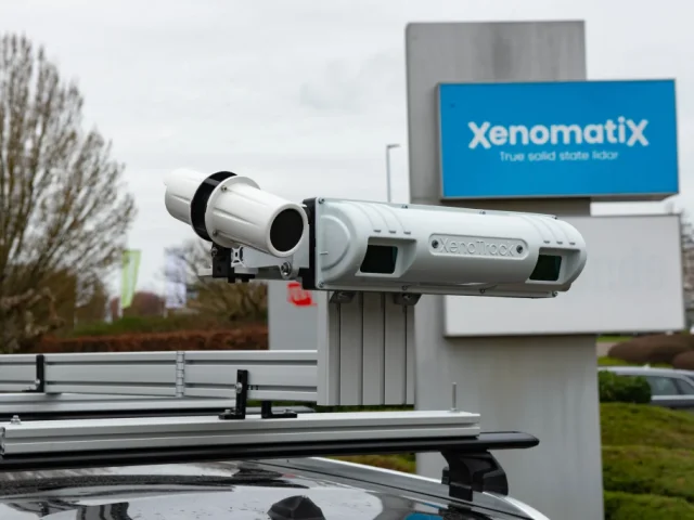
Xenomatix XenoTrack True Solid-State Road Profiling LiDAR The Xenomatix XenoTrack is a revolutionary true solid-state 3D LiDAR system engineered specifically for high-precision road surface profiling, pavement quality inspection, and autonomous vehicle ADAS testing. Unlike traditional mechanical scanners with spinning mirrors, XenoTrack utilizes semiconductor solid-state optics to deliver immune-to-vibration, millimeter-scale 3D surface geometry. Seamlessly mounted on […]
Monitoring is used to determine the movement and deformation of any structure.