Res2DInv & Res3DInv | 2D/3D ERT & IP Inversion Software
Available to buy or rent. Training and local support included.
Product details
Product Overview
Seequent Res2DInv & Res3DInv – Industry-Standard 2D & 3D ERT and IP Inversion Software
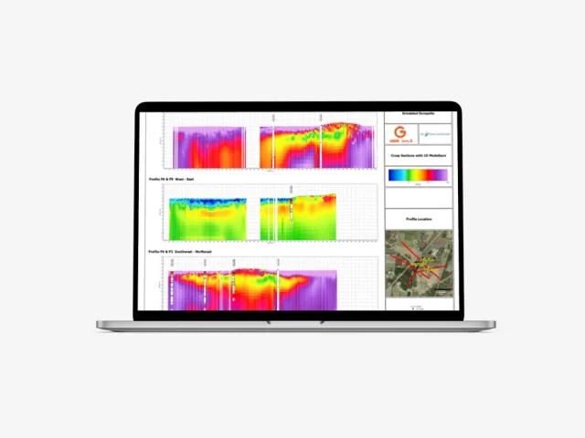
Transform complex electrical resistivity and induced polarization datasets into geologically reliable 2D cross-sections and 3D subsurface models
Product Description:
Seequent Res2DInv and Res3DInv (part of Aarhus GeoSoftware / Seequent) are the world’s benchmark software packages for processing and inverting 2D and 3D Electrical Resistivity Tomography (ERT), Direct Current (DC) resistivity, and Induced Polarization (IP) survey data. Continuously refined over more than 25 years of research and field application, Res2DInv and Res3DInv deliver fast, stable, and mathematically robust inversion algorithms designed to handle diverse survey configurations on land, in boreholes, and across aquatic environments.
Engineered to support projects of any scale—from rapid environmental site assessments to district-scale mineral exploration campaigns—the software enables geophysicists, hydrogeologists, and geotechnical engineers to resolve complex subsurface structures with confidence. Users can execute smooth L2-norm or sharp blocky L1-norm inversions, incorporate known geological boundaries as a priori constraints, and model time-lapse changes over time. Fully integrated into the broader Seequent and Aarhus GeoSoftware ecosystems, Res2DInv and Res3DInv streamline data flow directly into Aarhus Workbench, Oasis montaj, and Leapfrog 3D geological modeling environments.
- Market-Leading Inversion Performance: Utilizes optimized 64-bit multi-threaded algorithms (supporting up to 256 GB RAM in Professional editions) to execute rapid, stable inversions on multi-million-node meshes and massive multi-electrode datasets.
- Smooth (L2) and Sharp (L1) Inversion Support: Choose between smoothness-constrained least-squares inversion (ideal for continuous gradients such as groundwater plumes or weathering zones) and robust blocky/sharp inversion routines (for defining abrupt lithological contacts, faults, and void boundaries).
- True 3D Inversion & 2D Line Combination (Res3DInv): Inverts true 3D grid acquisitions directly or merges multiple parallel and intersecting 2D ERT/IP profiles into a unified, continuous 3D volumetric model with horizontal depth slices and vertical cross-sections.
- Universal Electrode & Array Compatibility: Supports standard and non-standard array geometries—including Wenner (, , ), Schlumberger, Dipole-Dipole, Pole-Dipole, Pole-Pole, Gradient, cross-borehole, surface-to-borehole, underwater water-bottom cables, and streamed floating electrode setups.
- Complex Topography & Finite-Element Modeling: Accurately incorporates rugged surface topography and steep slope profiles using adaptive finite-element and finite-difference modeling meshes to eliminate geometric inversion artifacts.
- Geological A Priori Constraints: Guide inversion outcomes by locking known subsurface parameters, embedding sharp structural boundaries from seismic or GPR horizons, and fixing resistivity values derived from exploratory borehole lithology logs.
- Dynamic 4D Time-Lapse Inversion: Jointly inverts repeated temporal survey sequences (2D and 3D) to track fluid movement, saltwater intrusion dynamics, dam embankment leakage pathways, contaminant migration, and seasonal permafrost variations.
- Full IP & Chargeability Inversion: Dedicated inversion modules for Induced Polarization data, allowing exploration teams to simultaneously invert resistivity and chargeability datasets to identify disseminated sulfides, mineralized vein systems, and clay content.
- Interactive Data Quality Control & Live Updates: Rapidly inspect pseudo-sections, cull erroneous data points based on RMS statistics, adjust bad electrodes, and review live model convergence updates during iterations.
- Seamless Seequent & Third-Party Export: Directly export inverted models, resistivity grids, and point clouds to Aarhus Workbench Essentials, Oasis montaj, Leapfrog, Voxler, CAD (DXF), and standard GIS formats (GeoTIFF, SHP, XYZ) for multi-disciplinary project reporting.