
ABEM GroundTEM Software | Transient Electromagnetic (TEM) Modeling
Available to buy or rent. Training and local support included.
Product details
ABEM GroundTEM Software – Advanced Transient Electromagnetic (TEM) Modeling & Inversion
Transform raw electromagnetic decay curves into clear, high-resolution subsurface resistivity models
Product Description:
ABEM GroundTEM is Guideline Geo’s dedicated processing, modeling, and inversion software engineered specifically for ground-based Transient Electromagnetic (TEM / TDEM) surveys. Developed to work hand-in-hand with the industry-leading ABEM WalkTEM and WalkTEM 2 systems, GroundTEM bridges the gap between field acquisition and final geophysical interpretation.
Tailored for hydrogeologists, environmental consultants, and exploration geophysicists, ABEM GroundTEM streamlines the entire data workflow—from raw transient decay curve inspection and ambient noise culling to automated 1D layered and smooth inversion. The software enables field crews and office analysts to accurately map deep aquifer systems, delineate saltwater intrusion boundaries, detect buried bedrock topography, and locate conductive mineral deposits with speed and high mathematical fidelity.
- Seamless ABEM WalkTEM & WalkTEM 2 Data Import: Directly imports raw TEM sounding files, receiver/transmitter loop geometries, current steps, and timing parameters without requiring third-party data converters.
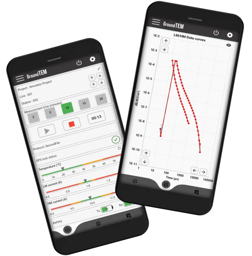
- Interactive Transient Curve Editing & QC: Real-time visualization of raw decay voltages (dB/dt) and apparent resistivity curves. Easily inspect individual time gates, mask noisy data points, and isolate cultural noise or powerline interference.
- Automated 1D Inversion Routines: Features robust inversion algorithms supporting both Smooth Models (continuous multi-layer resistivity distribution for complex gradients) and Few-Layer Models (sharp boundary delineation for distinct stratigraphy and water tables).
- Integrated Forward Modeling: Allows geophysicists to simulate theoretical TEM sounding responses based on anticipated synthetic geological models to evaluate signal penetration and optimize loop configurations prior to field deployment.
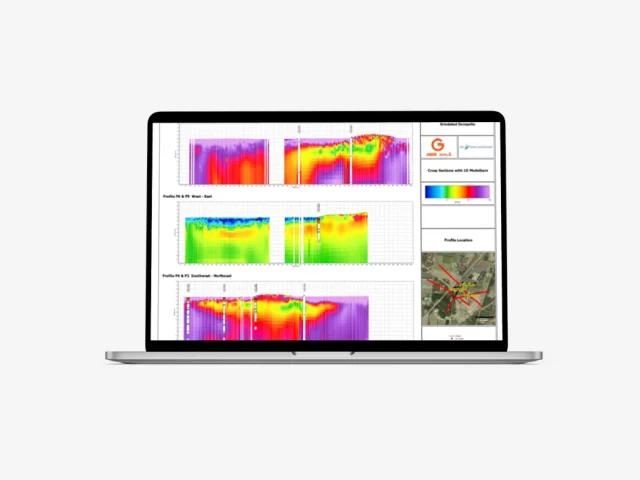
- Multi-Sounding Profile & Cross-Section Generation: Stitches individual soundings into continuous 2D resistivity-depth cross-sections along survey lines, providing an intuitive view of subsurface hydrogeological structures.
- Field-Ready Fast Processing: Lightweight and responsive architecture runs smoothly on standard field laptops and rugged tablets, enabling on-site inversions to verify data quality before dismantling transmitter loops.
- Comprehensive Data Export & Reporting: Exports processed models, sounding locations, and inverted resistivity grids to standard CSV, XYZ, and graphic formats for seamless integration into GIS (ArcGIS, QGIS), CAD, and professional geophysical reporting platforms.