

Contact Us Contact us
MALÅ MIRA HDR
MALÅ INSTRUMENT PRODUCTS

MALÅ MIRA HDR

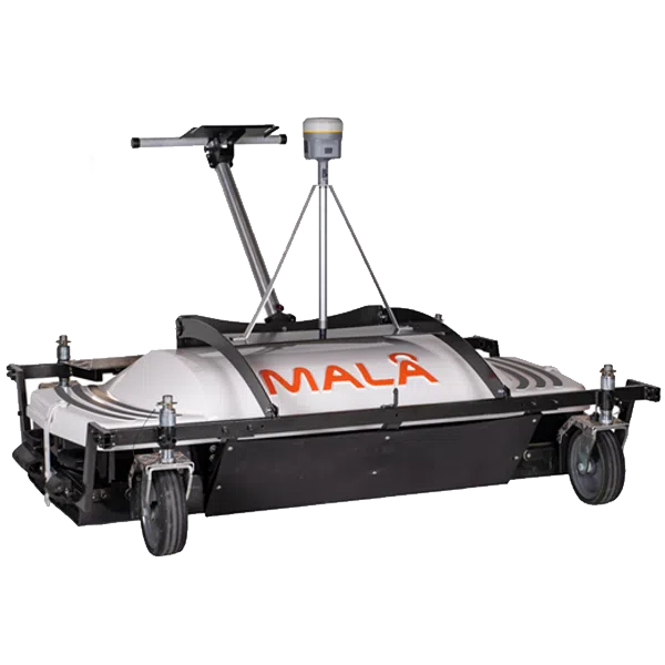
The MIRA HDR is a cost-effective 3D GPR array, optimized for mapping large areas

Available to buy or rent. Training and local support included.

Product details

MALÅ MIRA HDR
Large-Scale 3D GPR Subsurface Mapping System

The MALÅ MIRA HDR is the world’s most advanced, high-density 3D GPR (Ground Penetrating Radar) array system designed specifically for large-scale, high-speed subsurface mapping. Engineered for ultimate production rates, this vehicle-towed array collects massive swaths of continuous 3D data in a single pass.

Powered by MALÅ’s High Dynamic Range (HDR) 32-bit platform, it delivers unmatched data resolution at highway driving speeds, making it the premier choice for mapping extensive utility networks, airport runways, and critical road infrastructure.

Maximum Productivity: Highway Speeds, True 3D Subsurface Cubes
Unrivaled density data for extensive infrastructure mapping

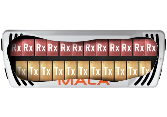
Traditional single-channel or manual-push GPR surveys fall short when tasked with mapping miles of highways or vast airport tarmac. The MALÅ MIRA HDR solves this bottleneck by combining an extensive array of antennas into a single towable chassis. It yields an incredibly tight cross-line channel sampling interval, ensuring that no targets or voids are missed. The system generates high-density 3D data cubes that visualize the subsurface with absolute structural precision.

Operating seamlessly at standard driving speeds, the MIRA HDR dramatically slashes project timelines and minimizes the need for costly traffic lane closures. It turns weeks of dangerous roadside surveying into a rapid, safe, vehicular drive-by operation, optimizing both field safety and commercial profitability.

MALÅ HDR (High Dynamic Range) GPR

The MALÅ MIRA has been re-engineered to take full advantage of MALÅ High Dynamic Range (HDR) technology, delivering superior GPR data quality, maximum resolution, and exceptional depth penetration.

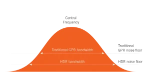
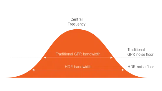
MALÅ HDR technology generates subsurface data with a significantly lower noise floor compared to traditional GPR systems. This reduced noise level provides a broader bandwidth than conventional systems that rely on time-interleaving. As a result, it eliminates background clutter, producing sharper radar profiles with higher contrast and the ability to map much deeper than non-HDR systems.

MALÅ GPR carrying solution

As with many MALÅ GPR systems, a variety of carrier solutions are available to suit diverse application requirements. The MALÅ MIRA HDR is engineered for seamless deployment on a standard light trailer for high-speed road surveys, or front-mounted on vehicles for high-precision mapping tasks.

Utilizing robust yet lightweight materials alongside a compact antenna array box design, the system can also be manually pushed with ease for localized grid surveys. Contact our team to discover the carrier setup best suited for your specific region and project demands.

MIRAsoft HDR

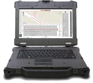
Powered by the new MIRAsoft HDR acquisition software, experience a modern, intuitive interface equipped with integrated navigation features designed to significantly streamline and accelerate your field surveys. The software provides comprehensive real-time monitoring of performance and data collection—helping operators maintain optimal speed and trajectory while displaying real-time tomographic slices and precise GPS positioning.

MIRAsoft HDR enables seamless acquisition of new multi-channel GPR datasets as well as convenient review of archived projects. It exports data across multiple standard formats for effortless integration with third-party processing suites. Detailed post-processing and 3D data interpretation can then be conducted using specialized 3D GPR software platforms such as rSlicer and GPR-SLICE.